# 7456
Popocatepetl – one of Mexico’s most active volcanoes, and located just 43 miles to the Southeast of Mexico City - has been rumbling ominously for several days, prompting authorities to raise their Volcano alert level to Yellow or Phase III.
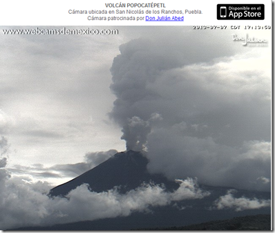
Steam can be seen rising from the crater in the Webcam shot below. New images may be viewed about once a minute, at this link.
The last major eruption was in 1947, but over the past 20 years there have been significant events in 1994, 2000, 2005, 2012, and again starting in May of this year.
Mexico's National Center for Prevention of Disasters (Centro Nacional de Prevención de Desastres or CENEPRED) Volcano Monitoring site has posted the following statement regarding Popocatepetl’s recent activity:
In the last 24 hours monitoring system of Popocatepetl volcano has registerde a persistent episode of low-frequency tremor that fluctuates between low and high amplitude accompanied by almost continuous emission of steam, gas and ash that heads northwest.
Additionally, yesterday at 19:28 hours the monitoring system registered an explosion that was followed by an episode of high-amplitude harmonic tremor that lasted four hours.
There have also been isolated episodes of lower amplitude harmonic tremor lasting 50 minutes and some exhalations with explosive component, generating a slight increase in the emission of gases and ash. One of the most important could be seen today at 08:24 when there was partial visibility to the volcano (see Figure 1) , (see seismogram) .
Climatic conditions in the area had not allow visibility during most of the time.
The Volcanic Alert Level is at Yellow, Phase 3.
CENAPRED places particular emphasis in the following recommendations:
1. Access is restricted within a radius of 12 km from the crater. Permanence in this area is not allowed.
2. The road between Santiago Xalitzintla (Puebla) and San Pedro Nexapa (Mexico State), including Paso de Cortes, is open only to controlled traffic.
3. To the authorities of Civil Protection, maintain preventive procedures, according to operative plans.
4. To the population, be aware of the official information emmited.
Popocatepetl Volcano is monitored continuously 24 hours a day.
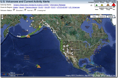
It may surprise some Americans to learn that the United States has 169 `active’ volcanoes within its borders – and while most are located in Hawaii and Alaska – there are about 40 in the `lower 48’ states.
U.S. Volcanoes and Current Activity Alerts
Major volcanic eruptions on the U.S. mainland are rare events, but they have the potential to be extremely disruptive when they do occur.
For that reason, emergency planners urge:
- Plan ahead. Have emergency supplies, food and water stored.
- Plan an evacuation route away from rivers or streams that may carry lahars.
- Keep a battery-operated radio available at all times.
- If there is an eruption predicted, monitor the radio or TV for information. Follow the advice given by authorities.
Note: Lahars are debris or mud flows from a volcano, and can be particularly dangerous.
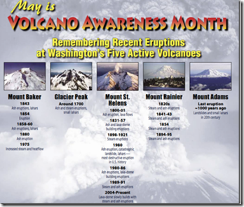
May is Volcano Awareness Month in Washington State, which has five major volcanoes in the Cascade Range; Mount Baker, Glacier Peak, Mount Rainier, Mount St. Helens and Mount Adams.
For more on Volcano hazards, and preparedness, you may wish to visit the State Of Washington’s Volcano Information and Preparedness webpage.


