NHC 5 Day Experimental Outlook
# 8979
With the caveat that this is 5-day experimental outlook, and that it is far to early in the game to begin thinking about what areas of the United States might be impacted, the National Hurricane Center has nonetheless increased the odds that a disturbance now approaching the Windward Islands will organize into a tropical cyclone to 60% over the next 5 days.
NWS NATIONAL HURRICANE CENTER MIAMI FL
200 PM EDT WED AUG 20 2014For the North Atlantic...Caribbean Sea and the Gulf of Mexico:
1. Shower and thunderstorm activity associated with an elongated area of low pressure located several hundred miles east of the Windward Islands has become a little better organized during the past few hours. Additional slow development of this system is possible during the next day or two, and a tropical depression could form as the system moves west-northwestward at 10 to 15 mph across the Lesser Antilles and into the Caribbean Sea. After that time, land interaction could limit development potential over the weekend.
Regardless of tropical cyclone formation, gusty winds and heavy rainfall are possible across portions of the Lesser Antilles, Puerto Rico, and the Virgin Islands on Thursday night and Friday. Interests in those islands should closely monitor the progress of this system. An Air Force Reserve Hurricane Hunter aircraft is scheduled to investigate this system tomorrow afternoon, if necessary. * Formation chance through 48 hours...medium...50 percent. * Formation chance through 5 days...high...60 percent.
While we’ve seen a very slow start to the 2014 Atlantic tropical season, we are only a couple of weeks away from the traditional `peak’ of Hurricane season, which means this is the time of year we need to be keeping a `weather eye’ on the tropics.
Although this system won’t pose a threat to the continental United States until at least sometime next week (assuming it does, at all) - if you live in Florida, or anywhere along the Gulf Coast – it is never too early to be thinking about your hurricane preparedness plans.
Interests in the Caribbean, of course, could be impacted much sooner - perhaps later this week or over the weekend. Although there are some early model runs suggesting a likely `path’ for this system, they are of only limited value before a tropical cyclone actually forms, and can easily lull one into complacency.
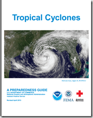
If you haven’t already downloaded the updated Tropical Cyclone Preparedness Guide, now would be an excellent time to do so.
NOAA’s NWS National Hurricane Center in Miami are the real experts in hurricane forecasting, and the only ones you should trust. They also have a Facebook page, where you can keep up with the latest tropical developments.
For additional official information you should bookmark your local Office of Emergency Management. Here you’ll be able to access local warnings, flood maps and evacuation information. To find your local one, you can Google or Yahoo search with your county/parish name and the words `Emergency Management’.
If you are on Twitter, you should also follow @FEMA, @CraigatFEMA, @NHC_Atlantic, @NHC_Pacific and @ReadyGov.
And lastly, a shortcut to my `How To Prepare For Hurricane Season’ post for 2014: Hurricane Preparedness Week: Make A Plan
