
NOTE: As of this posting, there are no Hurricane watches or warnings for Florida, and no evacuation orders. But both are coming (either later today or early Monday).
#18,342
With the dual caveats that soon-to-be Hurricane Milton is still 80 hours away, and both its forecast track and intensity (CAT 3) at landfall are subject to change, it is difficult as someone born and raised in St. Petersburg not to shudder at the implications of the NHC graphic above.
For Tampa Bay - home to more than 3 million people - this is pretty close to the worst-case scenario, as it would drive a huge storm surge up into the bay.
A CAT 4 or 5 storm, or a track another 15-20 miles further up the coast would be worse, of course. While a landfall even 30 to 40 miles further south would greatly reduce the storm surge in Tampa bay.
But that would only shift the disaster to other coastal communities who are still reeling from last week's devastation from Hurricane Helene.
Even tiny shifts in the track can have huge impacts on storm surge and who needs to evacuate. The flood zones for the Tampa Bay area (below) illustrates just how vulnerable this region is.

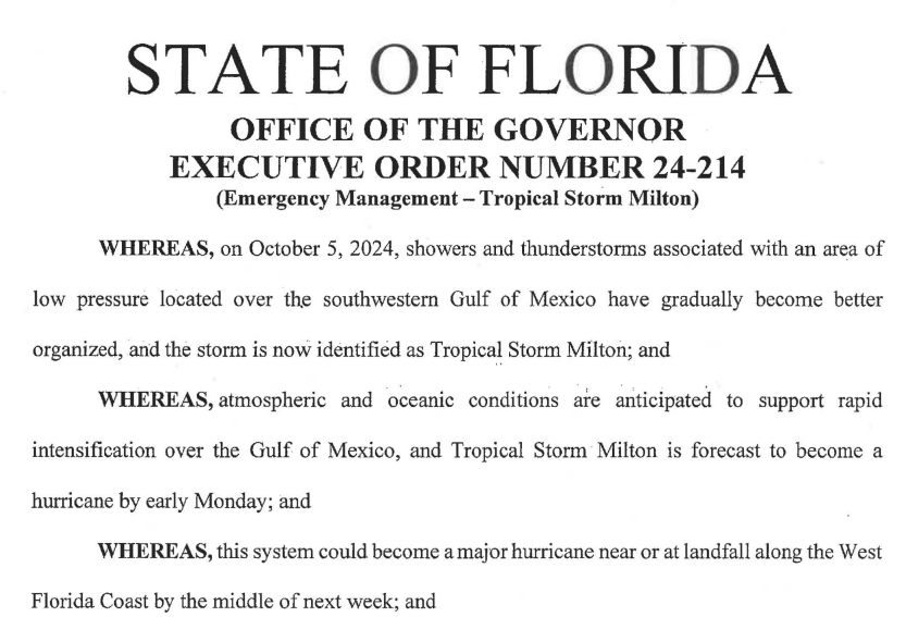
But the broader threat from Milton extends across much of the state. Because of the enormity of this threat, last night the Governor issued a State of Emergency for 35 counties.
This will, among other things, allow people to get a 30-day emergency supply of Rx meds.
Regardless of where Milton makes landfall, power outages are likely to be extensive and prolonged. Water and sewer services may be offline, roads and bridges may be blocked, flooded, or damaged, and emergency services (EMS, fire, police) may be severely degraded.
Banks, gas stations, grocery stores, pharmacies, doctors, and other essential services may be shuttered for days or weeks. Stores that are able to reopen may not be able to process Credit or Debit cards. And for thousands of families, there may be no home to return to after the storm.
Barring some major shift in the path, I'll be among the millions who will be forced to evacuate on Tuesday, taking only what I can fit in my car. Thankfully, I have a `Disaster Buddy', who will take me and the cat in.
Not everyone is that lucky, and many may end up in emergency shelters for days. Those who live on the barrier islands may not be able to return for weeks.
The last time a major hurricane made a direct hit on Tampa Bay (1921), its population was 1/10th what it is today, and practically no one lived on the beaches, or the barrier islands. The damage from Helene just last week is the worst we've taken since then.
We've had close calls, of course.
Hurricane `Easy' in 1950. Hurricane Donna in 1960, Agnes in 1972, and the no name `storm of the century' in March 1993. In 2004 Cat 4 Hurricane Charley was headed directly for Tampa when it unexpectedly veered east into Ft. Myers.
While I'm hoping for a reprieve, I'll be spending the next 2 days preparing to bug-out. I've got my flu shot scheduled for tomorrow morning (they may be hard to get post-Milton), just like I got my COVID shot before Helene.
I'm going to try to get an emergency 30-day supply of my Rx meds (allowed under the State of Emergency), and I'll be staging what I am able take with me (clothes, Rx meds, important papers, Emergency gear, etc.), so I can quickly pack the car on Tuesday.

Evacuation could be a nightmare, since millions may be ordered to leave, there are limited roads and bridges out of the affected areas, and the weather is expected to deteriorate on Monday (heavy rains). I expect it will take hours to drive the 40 miles to my bug-out location.
I'll take my laptop, but I fully expect to be incommunicado for some time. I'll try to get word to Sharon at FluTrackers (who is also in the path), after the storm.
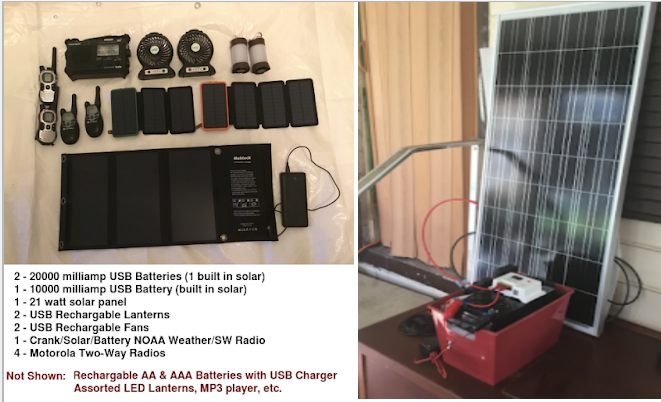
I'll be taking my solar panels, batteries, and accessories (see How Not To Swelter In Place). The one (minor) consolation is that it isn't August, and excessive heat should be less of a problem.
In the end, you can only do what you can do, and hope it turns out to be enough.
So, if you live anywhere near the west coast of Florida, in a flood-prone region, or live (as I do) in a mobile home away from the coast, now is the time to start planning what you will do tomorrow, and Tuesday, as the storm approaches.
The danger is that too many people will wait too long before deciding whether they will evacuate. Some may be lulled by a forecast track that seems to spare them - but forecasts can change - leaving little time to act.
While I'll be doing usual hurricane preparedness blogs - and I follow (and highly recommend) Mark Sudduth's Hurricane Track, and Mike's Weather page - your primary source of forecast information should always be the National Hurricane Center in Miami, Florida.
These are the real experts, and the only ones you should rely on to track and forecast the storm.
If you are on Twitter, you should also follow @FEMA, @NHC_Atlantic, @NHC_Pacific and @ReadyGov, and of course take direction from your local Emergency Management Office.
For more Hurricane resources from NOAA, you'll want to follow these links.
HURRICANE SAFETY
- NWS: Hurricane Safety Tips and Resources
- NOAA Education: Hurricane Safety, explained
- Ocean Today: Hurricane Safe videos
- CDC: Hurricanes and COVID-19
- CDC: Public Shelters During COVID-19
ADDITIONAL RESOURCES
- Delivering the Right Message: Understanding Forecasts & Impacts
- Current NHC Forecast
- Ready.gov
- #HurricaneStrong