Mariner’s Poem On Hurricanes
June too soon.
July stand by.
August look out you must.
September remember.
October all over.- Published in “Weather Lore” by R. Inwards in 1898
# 8694
June 1st marks the start of this year’s Atlantic Hurricane season, and while strong June hurricanes are fairly rare, named June storms occur roughly every other year. The chart above shows that hurricane season begins slowly, reaches a peak in mid-September, and then slowly peters out by December.
The strongest recorded June storm was Hurricane Audrey in 1957, the only one known to reach CAT 4 strength. Audrey claimed 550 lives after it made landfall in eastern Texas and western Louisiana. Below are a few notable June Hurricane tracks, including Audrey.
Even tropical storms and weak hurricanes are capable of doing severe damage and taking lives.
Hurricane Agnes (1972), which I remember well as the first disaster I worked as a Red Cross volunteer, caused relatively little damage to Florida where it made landfall as a minimal CAT 1 storm. Her impact was was to be far greater more than a 1000 miles inland, where she would generate devastating floods in the days that followed.
Of the 122 deaths associated with this storm, only 9 occurred in Florida where Agnes made landfall. The rest - 113 deaths - were due to inland fresh water flooding, with New York and Pennsylvania suffering the highest loses.
All of which proves you don’t have to live anywhere near the coastline to be severely impacted by one of these storms.
Slow moving tropical storm Allison - in June of 2001 – proved more than deadly producing 55 fatalities and causing in excess of $9 billion in damage to Southeast Texas - primarily due to its torrential rains.
When hurricanes and tropical storms do form early in the season, they tend to form in the warmer, comparatively shallower waters of the the Gulf of Mexico and Caribbean. And that sometimes means less warning time.
Further out to sea the Atlantic waters are still too cold, and and wind and Saharan dust conditions aloft too unfavorable, to promote much in the way of long-track storm development.
June Climatology
Credit NOAA
Which means that while it is very early in the Hurricane season, it isn’t too early to be prepared. Last week we spent a considerable amount of time looking at hurricane preparedness, which you can review by clicking this link.
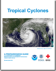
If you haven’t already downloaded the updated Tropical Cyclone Preparedness Guide, now would be an excellent time to do so.
NOAA’s NWS National Hurricane Center in Miami are the real experts in hurricane forecasting, and the only ones you should trust. They also have a Facebook page, where you can keep up with the latest tropical developments.
For additional official information you should bookmark your local Office of Emergency Management. Here you’ll be able to access local warnings, flood maps and evacuation information. To find your local one, you can Google or Yahoo search with your county/parish name and the words `Emergency Management’.
If you are on Twitter, you should also follow @FEMA, @CraigatFEMA, @NHC_Atlantic, @NHC_Pacific and @ReadyGov.
And lastly, a shortcut to my `How To Prepare For Hurricane Season’ post for 2014: Hurricane Preparedness Week: Make A Plan


