# 5788
The internet provides a unique platform for watching Irene’s trek across the mid-Altantic states, with resources that include live coastal radars, NOAA weather radio broadcasts, streaming radio and TV coverage from cities all across the region, beach front and traffic webcams and even scanners to listen to local emergency radio traffic.
For those in the path of the storm, or those with friends or family in the affected area, this can help provide valuable information as to what is going on during and after the storm.
And for those who are simply curious as to the impact of this hurricane, this is a convenient way to monitor it.
This afternoon, and probably again later in the weekend, I intend to post some of the web resources I’ll be monitoring as the storm comes ashore.
Disclaimer: These links are offered without warranty or endorsement (except for the NHC & NOAA links), and you visit them at your own risk.
It is always prudent to use up-to-date antivirus software, and decline to install any software from vendors you do not trust, when surfing the net.
The focus today with be on North Carolina, where Irene is expected to make landfall tomorrow morning, but I’ll provide links further up the coast in a later post.
Nearly all of these links are subject to storm related outages and bandwidth limitations, so don’t be surprised if you find some of them offline during the course of the next couple of days.
First stop, of course, is the National Hurricane Center in Miami, Florida that tracks the storm. You can also visit the Wilmington, NC and Newport/Morehead City, NC National Weather Service Weather Forecast Offices (WFO) for local advisories.
Similarly, NOAA Weather Radio All Hazards broadcasts are available online as live streaming audio although they are hosted by other entities, including Weather Underground.
Via Weather Underground we’ve a couple of live radar feeds you can access. You can just begin to see Irene’s eye in this snapshot taken at 3:00 pm EST today on the Wilmington Radar.
A little further north you’ll find the Morehead City radar.
Interesting, but often frustrating and requiring patience, are the live streaming webcams scattered across North Carolina. These camera feeds tend to suffer from heavy web traffic, are sometimes poorly maintained, and are prone to going offline when a storm strikes.
Still, there are plenty to choose from, and when you can connect, they can make for interesting viewing.
Raleigh broadcaster WRAL.Com has an interactive map with a number of these cams available. Fair warning: About half of the ones I checked were not currently accessible.
WRAL also has a page with streaming traffic cams from across the state.
Watch recently captured video from major highways in the Triangle area. Video clips show approximate time that the video was captured. Clips, taken from locations in Wake, Durham and Orange counties, last about 15 seconds are updated about every 4 minutes.
For a list of North Carolina TV stations, some of which will be providing live, 24-hour streaming coverage of Irene’s arrival, you can go to:
North Carolina TV stations
You’ll have to find steaming coverage by trial and error, as some stations may not be streaming.
Live streaming audio is also available from a number of radio stations in North Carolina. A webpage with links to their websites can be found at:
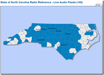
More than 140 local, county and state emergency services frequencies (fire, police, EMS) can be assessed via RadioReference.com. The interactive maps shows counties with scanner monitoring. Click on the county, and you’ll be presented with a list of feeds.
Hurricane City, a well known hurricane tracking site and forum, broadcasts on USTREAM when hurricanes approach the coast and you can watch it HERE.
You’ll also find live hurricane coverage and chaser cam footage from Mark Sudduth’s HurricaneTrack.com.
Emergency Stream provides live, raw, and uncut audio and video feeds from all over the country. Frankly, there’s no telling what you will find there. Local TV broadcasts, raw helicopter camera feeds, etc.
Your best option is to select either audio or video feeds, and then the state from the list that appears on the right side of the page. These links are transient, so some channels may be active while others are not.
Check all of the links, and check back often.
USTREAM, mentioned earlier, provides a venue for all types of broadcasting. Enter HURRICANE or IRENE in the search box for a list of current streaming video. You’ll find everything from storm chaser video to live feeds from hotels on the Altantic beaches.
Since anyone can broadcast on USTREAM, accept anything you see or hear cautiously. Still, USTREAM can be a terrific resource.
I’ll try to have more resources later, and will update this blog post if I find anything tonight. But this should give you a pretty good start on following the storm.


