*** UPDATED ***
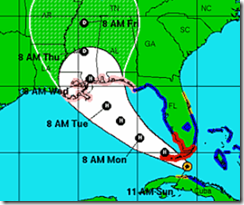
11 am Track from the NHC 
As of the 11am update: THE HURRICANE WATCH IS EXTENDED WESTWARD ALONG THE LOUISIANA COAST TO JUST EAST OF MORGAN CITY...INCLUDING METROPOLITAN NEW ORLEANS
AND LAKE PONTCHARTRAIN.
# 6519
While the forecast is gradually improving for the west central peninsula of Florida, the threat of Isaac making landfall anywhere from the panhandle west to Louisiana has increased overnight.
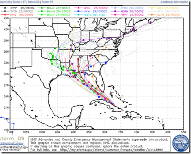
With each model run, the forecast track has shifted a little more to the west. As you can see by the spaghetti models below, there remains a fair amount of divergence in forecast tracks.
Today’s 11am Discussion cautions:
SINCE THE DYNAMICAL MODEL CONSENSUS HAS SHIFTED WESTWARD...THE OFFICIAL TRACK FORECAST IS MOVED A BIT TO THE WEST OF THE PREVIOUS ONE. THIS REQUIRES AN EXTENSION OF THE HURRICANE WATCH WESTWARD ALONG THE LOUISIANA COAST. IT SHOULD BE NOTED THAT THERE IS GREATER THAN USUAL UNCERTAINTY IN THE TRACK FORECAST.
Isaac remains a tropical storm, but conditions are generally favorable for intensification over the next 48 to 72 hours. The National Hurricane Center estimates that Isaac could be a Category 2 hurricane before it nears the coast.
And a reminder, you don’t have to be directly in the path of this storm to be affected by it.
Tropical Storm force winds extend 200 miles from the center, and landfalling tropical systems have been known to generate tornadoes and cause flooding hundreds of miles away.
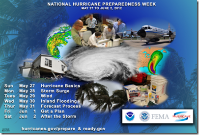
Finally, the end of May was National Hurricane Preparedness week. You can revisit some of this year’s PSAs and preparedness advice from NOAA by clicking this link, or the graphic below.


