Credit NOAA
# 6984
March 3rd thru 9th, 2013 is National Severe Weather Preparedness Week - and being a second generation Floridian who has spent years living aboard boats - I have a well honed respect for the power of storms.
Each year I devote a number of blogs to weather preparedness, including a full week of articles in May in advance of the upcoming hurricane season.
After a disastrous 2011 tornado season, one that saw more than 1,700 confirmed twisters claiming more than 550 lives, 2012 was thankfully a far quieter year. Still, nearly 1,000 tornadoes were reported, causing well over $1.6 Billion dollars in damage, and killing 69 Americans.
Add to that hurricanes, severe thunderstorms, derecho winds, hail, and lightning . . . and every year produces ample outbreaks severe weather across the United States.
Despite the lull, last year more than 450 deaths and 2,600 injuries were attributed to various weather-related causes across the nation.
NOAA’s Weather-Ready Nation website lists a Calendar of events designed to raise awareness, and preparation, for weather-related emergencies.
Be a Force of Nature when it comes to extreme weather by learning about potential hazards. Help advance the Weather-Ready Nation by being prepared for the worst. NOAA’s National Weather Service and its partners encourage individuals, families, businesses and communities to know their risk, take action, and be an example when it comes to dangerous weather.
- March 3-9, 2013: Severe Weather Preparedness Week
- March 18-22, 2013; Flood Awareness Week
- March 24-30, 2013; Tsunami Awareness Week
- May 18-24, 2013; Safe Boating Week
- May 26 - June 1, 2013; Hurricane Preparedness Week
- June 1: 2013 Atlantic Hurricane Season Officially Begins
- June 2-8, 2013; Rip Current Awareness Week
- June 23-29, 2013; Lightning Safety Awareness Week
In addition to these national events, many states have their own awareness weeks for particular weather hazards. See the Weather Awareness Events Calendar for information from your state.
The focus this week is:
Be a Force of Nature: National Severe Weather Preparedness Week March 3-9, 2013
Know your risk. Take action. Be an example.
New: Presidential Message for National Severe Weather Preparedness Week 2013
Be a Force of Nature this year with National Severe Weather Preparedness Week, March 3-9, 2013.
During this week, NOAA and FEMA are highlighting the importance of planning and practicing how and where to take shelter before severe weather strikes. Being prepared to act quickly can be a matter of life and death.
Being a force of nature goes beyond taking appropriate preparedness action. It’s about inspiring others to do the same. We’re asking people not only to be prepared, but also to encourage their social network to act by texting, tweeting, or posting a Facebook status update.
Be a Force of Nature Toolkit – get involved
You, too, can Be a Force of Nature in your community. Tweet, write a blog post, develop a presentation – we have everything you need to get started. Be a local hero and spread the word about preparing for severe weather.
No matter where you live, this weekend’s time change is a good reminder to change your smoke detector batteries, and to double check your NOAA weather radio, flashlights, and first aid kit.

You should also review your family’s emergency communication plan - and if you haven’t already done so - decide where you would go in your home or business if severe weather threatens.
Every home and office should have a NOAA weather radio. Once thought of as mainly a source of local weather information, it has now become an `All-Hazards' alert system as well.
In order to receive these broadcasts, you need a special receiver. Many of these radios have a built in `Tone Alert', and will begin playing once they receive a special alert signal from the broadcaster.
To keep track of severe storm forecasts, you can visit NOAA’s Storm Prediction Center online. There you’ll find interactive maps showing current and anticipated severe weather threats all across the nation.
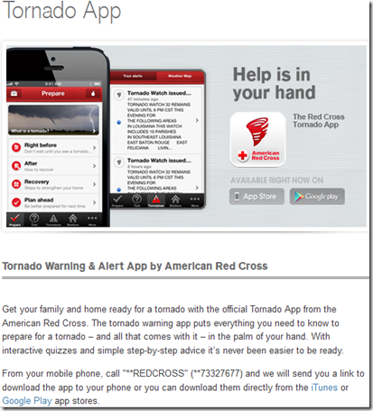
For those on the go who would like an app (android or iPad) that will sound an alert when tornado warnings are issued in your area, the American Red Cross has recently released one.
Sadly, despite scores of major disasters (often weather related) that occur in this country each year, most Americans remain woefully unprepared to deal with emergencies.
Agencies like FEMA, READY.GOV and the HHS are constantly trying to get the preparedness message out, so that when (not `if') a disaster does occur, human losses can be minimized.
For more information on how to prepare for emergencies, large and small, the following sites should be of assistance.
FEMA http://www.fema.gov/index.shtm
READY.GOV http://www.ready.gov/
AMERICAN RED CROSS http://www.redcross.org/


