Showing posts with label seismic. Show all posts

Friday, July 18, 2014

USGS: Updated U.S. Seismic Risk Hazard Maps

image


# 8846


Yesterday the USGS released a 243 page PDF report outlining the revised seismic hazard risks for the United States – their first major update since 2008 – and among its findings it reports a higher risk of strong quakes in the Eastern United States than previously appreciated. 


Be warned, with hundreds of maps and graphics, this is a very large (113mb) download.


image


Documentation for the 2014 Update of the United States National Seismic Hazard Maps

By Mark D. Petersen, Morgan P. Moschetti, Peter M. Powers, Charles S. Mueller, Kathleen M. Haller, Arthur D. Frankel, Yuehua Zeng, Sanaz Rezaeian, Stephen C. Harmsen, Oliver S. Boyd, Ned Field, Rui Chen, Kenneth S. Rukstales, Nico Luco, Russell L. Wheeler, Robert A. Williams, and Anna H. Olsen
Abstract

The national seismic hazard maps for the conterminous United States have been updated to account for new methods, models, and data that have been obtained since the 2008 maps were released (Petersen and others, 2008). The input models are improved from those implemented in 2008 by using new ground motion models that have incorporated about twice as many earthquake strong ground shaking data and by incorporating many additional scientific studies that indicate broader ranges of earthquake source and ground motion models. These time-independent maps are shown for 2-percent and 10-percent probability of exceedance in 50 years for peak horizontal ground acceleration as well as 5-hertz and 1-hertz spectral accelerations with 5-percent damping on a uniform firm rock site condition (760 meters per second shear wave velocity in the upper 30 m, VS30). In this report, the 2014 updated maps are compared with the 2008 version of the maps and indicate changes of plus or minus 20 percent over wide areas, with larger changes locally, caused by the modifications to the seismic source and ground motion inputs.


Although earthquakes in the Eastern half of the United States have been recorded in the past (including the Charleston, SC earthquake of 1886), the August 2011 5.8 earthquake that rocked Virginia and the Nation’s capital (see USGS Statement On The Virginia Earthquake) provided fresh evidence not only of their potential to occur,  but also how widely felt they may be (see USGS: Eastern Earthquakes - Rare But Powerful).


Another strong quake a few months later in the Heartland (see 5.6 Mag Quake Rattles Oklahoma), has been followed by hundreds of additional quakes in a region not expected to produce that much seismic activity. 


Additional earthquake research has turned up new fault lines in California, and perhaps most worrisome of all, found the potential for a much larger quake from the Cascadia Fault in the Pacific Northwest than previously estimated (see Just A Matter Of Time for more on this threat)


While all 50 states have at least some seismic potential (yes, even Florida), 42 states are viewed as having a reasonable chance of seeing a damaging quake in the next 50 years, and 16 states in particular are considered at highest risk.  The USGS press release states:


The hazard is especially high along the west coast, intermountain west, and in several active regions of the central and eastern U.S., such as near New Madrid, MO, and near Charleston, SC. The 16 states at highest risk are Alaska, Arkansas, California, Hawaii, Idaho, Illinois, Kentucky, Missouri, Montana, Nevada, Oregon, South Carolina, Tennessee, Utah, Washington, and Wyoming.


While they acknowledge the risks of man-made earthquakes – due primarily to fracking and injection wells – research into these hazards is just getting started.  The USGS states:


Induced Earthquakes … Research Underway

Some states have experienced increased seismicity in the past few years that may be associated with human activities such as the disposal of wastewater in deep wells.

One specific focus for the future is including an additional layer to these earthquake hazard maps to account for recent potentially triggered earthquakes that occur near some wastewater disposal wells. Injection-induced earthquakes are challenging to incorporate into hazard models because they may not behave like natural earthquakes and their rates change based on man-made activities.


While it may not be predictive of future events, so far 2014 has provided a major uptick in seismic activity in the United States, and around the globe.  Southern California, Alaska, and California have all reported increased activity (see LA Times Quakes are increasing, but scientists aren't sure what it means).


Last December, in Dr. Lucy Jones: `Imagine America Without Los Angeles’, we looked at a presentation given by Dr. Jones at the  annual meeting of the American Geophysical Union (held this year in San Francisco),  that emphasized that should the `big one’ hit Southern California, we could literally `lose’ Los Angeles.


She warned that the damage could be far greater, and last much longer, than most people believe.  While 99 out of 100 modern buildings might remain standing, the (often buried) infrastructure needed to provide water, electricity, internet connectivity, and natural gas – the lifeblood -  to the region could be devastated (see CBS News report).


If this sounds like hyperbole, in 2010 (see Revised Risk Of `The Big One’ Along San Andreas Fault) we looked at a study that suggested that Southern California may be more overdue for another major quake than previously thought, and in the following year (see Estimating The Economic Impact Of A San Andreas Quake) we looked at a report from the U.S. Bureau of Labor Statistics that endeavored to gauge the crippling impact that a highly feasible (and long overdue) 7.8 magnitude Southern California earthquake would have on jobs and local businesses.

image

Download PDF file

A quake of this magnitude, they estimate, could affect  430,000 businesses and 4.5 million workers and deliver a devastating – and prolonged – blow to the local (and national) economy.


While attempts at predicting earthquakes have met with little success, we do know that over time, seismically active regions will be hit again and again, and that the only defense is to be prepared for when that happens.


Seismic threats extend beyond earthquakes, as they encompass volcanic eruptions (see Washington State: Volcano Awareness Month) - and Tsunamis – both of which have the ability to affect both people and property thousands of miles away from the originating event  (see The USGS West Coast Tsunami Scenario Report & East Coast Tsunami Threats).


Which is why everyone should have a disaster plan, not just those who live in an earthquake zone.


As a bare minimum, everyone should have a well thought out disaster and family communications plan, along with a good first aid kit, a `bug-out bag’, and sufficient emergency supplies to last at least 72 hours.


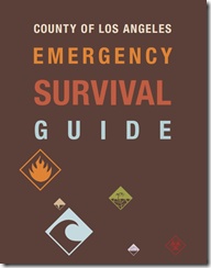
In When 72 Hours Isn’t Enough, I highlighted  a colorful, easy-to-follow, 100 page `survival guide’ released by Los Angeles County, that covers everything from earthquake and tsunami preparedness, to getting ready for a pandemic.

image

The guide may be downloaded here (6.5 Mbyte PDF).

While designed specifically for the nearly 10 million residents of Los Angeles County, this guide would be a valuable asset for anyone interested in preparing for a variety of hazards. And in Los Angeles, the advice is to have emergency supplies (food, water, etc) to last up to 10 days. In my humble opinion, 2-weeks in an earthquake zone isn’t overkill.
 

Working to improve earthquake awareness, preparation, and safety is Shakeout.org, which promotes yearly earthquake drills and education around the country (see NPM13: A Whole Lotta Shakeouts Going On).  If you live in one of these seismically active areas, I would encourage you to take part in these yearly drills.

image

To become better prepared as an individual, family, business owner, or community to deal with all types of disasters, I would invite you to visit the following preparedness sites.


FEMA http://www.fema.gov/index.shtm

READY.GOV http://www.ready.gov/

AMERICAN RED CROSS http://www.redcross.org/


And lastly, in NPM13: The Greatest Prep Of All,  I wrote about what I consider to be the most important preparedness step you can take – having, and being,  a disaster buddy.  Cultivating a network of family and friends to whom you can turn for help in a disaster, to who can turn to you for aid,  if they need it.


Because no matter where you live, its just a matter of time before the next disaster strikes.

Sunday, January 26, 2014

USGS: 6.0 Earthquake Strikes Greece

image

Credit USGS 


# 8223


A strong, relatively shallow earthquake and a moderate aftershock have struck the Southern coastline of Greece, and preliminary reports indicate there has been some local damage and possible injuries.  The towns closest to the epicenter are generally small (3K-5K pop.), and so the damage may not be as great as it might have been in a more populated area.


image

image


When it comes to earthquakes we usually think first of the Pacific’s Ring Of Fire, but Europe has a long history of destructive quakes as well.


In 2011,  in A Look At Europe’s Seismic Risks, we took look at some of the devastating earthquakes to strike Europe over the past 700 years, including the quake that leveled the Swiss town of Basel in 1356 and the horrific earthquake and tsunami that struck Portugal in 1755 on November 1st (All Saint’s Day).


In December of 2011, in WHO e-Atlas Of Natural Disaster Risks To Europe, we looked at some of the seismic risks to Europe. Also in 2011 (see UNDP: Supercities At Seismic Risk) we saw a report that stated that half of the world’s supercities (urban areas with 2 million – 15 million inhabitants) are at high risk for seismic activity.


And more recently, in January of this 2012 (see UN Agency Warns On Global Seismic Risks), the United Nations International Strategy For Disaster Reduction (UNIDSR.Org) issued a cautionary warning about ignoring seismic threats.


While we can’t predict where the next earthquake will strike, or do anything to stop it, we can prepare to deal with one when it happens.


For good, solid information on how prepare for `the big one’ (even if you live someplace other than Los Angeles), I would recommend you download, read, and implement the advice provided by the The L. A. County Emergency Survival Guide.

image

While US-centric, FEMA  has an earthquake hazard webpage with a lot of resources that would be of use to just about anyone, including the following preparedness information.


Emergencies happen every day.  Disasters, admittedly, less often. But in either event, preparedness is key.

Monday, October 14, 2013

California Quakes : Concrete Concerns

image

SCEC Interactive Map – Significant Southern California Quakes


#7855


Yesterday the Los Angeles Times ran an extensive report on an in-house analysis of a number of large, and extremely vulnerable-during-an-earthquake, concrete buildings in that city.  The authors (Rong-Gong Lin II, Rosanna Xia and Doug Smith) state that the city has been aware of the dangers for decades, but has refused to require building owners to retrofit their properties for earthquake safety, despite the fact that the area is believed `overdue’ for a major earthquake.


It’s an informative report on seismic risks, earthquake resistant building techniques, and local politics. Well worth reading.


CONCRETE RISKS

The city has rejected calls to make a list of concrete buildings at risk of collapsing in a major quake, but a Times analysis finds there could be more than 1,000 — many of them homes and offices.
By Rong-Gong Lin II, Rosanna Xia and Doug Smith

October 13, 2013

More than 1,000 old concrete buildings in Los Angeles and hundreds more throughout the county may be at risk of collapsing in a major earthquake, according to a Times analysis.

By the most conservative estimate, as many as 50 of these buildings in the city alone would be destroyed, exposing thousands to injury or death.

(Continue . . . )


While admittedly a local story, Los Angeles isn’t the only major U.S. city with concrete buildings that lies in an active seismic zone; Memphis, St. Louis, Charleston, Seattle, Portland, San Francisco, Salt Lake City  . . . even New York City, all have varying degrees of seismic risks.  


image

Seismic Hazard Map – Credit USGS


But the West Coast, probably more than any other region of the United States, is viewed as being at particular risk.


In 2010 (see Revised Risk Of `The Big One’ Along San Andreas Fault) we looked at a study that suggested that Southern California may be more overdue for another major quake than previously thought, and in the following year (see Estimating The Economic Impact Of A San Andreas Quake) we looked at a report from the U.S. Bureau of Labor Statistics that endeavored to gauge the crippling impact that a highly feasible (and long overdue) 7.8 magnitude Southern California earthquake would have on jobs and local businesses.

image

Download PDF file

A quake of this magnitude, they estimate, could affect  430,000 businesses and 4.5 million workers and deliver a devastating – and prolonged – blow to the local (and national) economy.


For a comprehensive guide on how you can prepare for `the big one’ (even if you live someplace other than Los Angeles), I would recommend you download, read, and implement the advice provided by the The L. A. County Emergency Survival Guide.

image


Large earthquakes can also generate massive tsunamis, which can travel thousands of miles in a matter of a few hours.  We’ve looked at the United State’s tsunami risks recently, in NPM13: The USGS West Coast Tsunami Scenario Report & East Coast Tsunami Threats.


It isn’t enough to have a kit, and a plan during an earthquake. You need to know what to do to protect life and limb while the shaking is going on.  And for that, we have the ever-growing Great Shakeout Drill (see  NPM13: A Whole Lotta Shakeouts Going On).


image


Later this week (Thurs, Oct 17 at 10:17am) , California, along with many other states, territories, and countries will hold their annual Great Shakeout Drill.  Millions of residents, from the United States and Canada, to New Zealand, Italy, and Japan, will take part in this yearly Drop, Cover, & Hold On drill. A video, demonstrating the technique is available on the California Shakeout Youtube Channel.

image


For more information on emergency preparedness, I would invite you  to visit:


FEMA http://www.fema.gov/index.shtm

READY.GOV http://www.ready.gov/

AMERICAN RED CROSS http://www.redcross.org/


And for some earlier blogs on the seismic hazards in the United States, and around the world, you may wish to revisit:

Just A Matter Of Time

Academics Debate Odds Of Tokyo Earthquake

UN Agency Warns On Global Seismic Risks


Sunday, July 21, 2013

6.5 Quake Rocks New Zealand

image

image

Map Credit USGS


# 7502

Overnight (EDT) a strong, shallow earthquake struck about 35 miles SSW of Wellington, New Zealand. Early reports include some structural damage and some power outages, but no reports (yet) of serious injuries.


New Zealand earthquake damages Wellington parliament –BBC Report


New Zealand is no stranger to seismic activity.  In  September of 2010 a 7.1 Magnitude quake struck near Christchurch, followed five months later by an even more damaging 6.3 aftershock (see NZ: Aftershocks, Rescue Attempts, Casualties, And The Mounting Toll).


Over the past two years a number of large aftershocks have been recorded (see 5.5 & 6.0 Aftershocks Strike Christchurch), along with fresh seismic activity from other fault lines.


New Zealand lies on a very active Pacific `ring of fire’ that has sparked large quakes and volcanic activity from New Zealand, to Japan, to Alaska, down the west coast of Canada and the United States, and to the tip of South America.


An Active Ring of Fire

image

Original Map – USGS


As you can see by the map above, while it was Wellington overnight, tomorrow it could just as easily be Tokyo, Anchorage, or the Pacific Northwest. Major earthquakes (7.0 Mag or greater) occur somewhere in the world roughly 17 times each year.


image

1. Based on observations since 1900.

2. Based on observations since 1990.

NOTE: The NEIC estimates that several million earthquakes occur in the world each year. Many go undetected because they hit remote areas or have very small magnitudes.

Source: National Earthquake Information Center, USGS


The inevitability of disasters like earthquakes, hurricanes, floods, and tornadoes is why government agencies such as FEMA and Ready.gov stress individual and community preparedness.


They know that it is really just a matter of time before another major disaster strikes, and that in extreme emergencies some families or individuals may be on their own for several days.


National Preparedness Month (September) is just five weeks away, and along with thousands of others across the country, AFD blog is once again proud to be part of this year’s NPM coalition.


But no one should wait until September to become better prepared.  Natural disasters don’t read calendars.


The County of Los Angeles Emergency Survival Guide calls for having 3 to 10 days worth of food and water. Personally, I believe that 2-weeks of supplies isn’t an unreasonable goal, particularly if you live in earthquake or hurricane country.


The L.A. guide may be downloaded here (6.5 Mbyte PDF).

image

For more information on preparedness, I would invite you  to visit:


FEMA http://www.fema.gov/index.shtm

READY.GOV http://www.ready.gov/

AMERICAN RED CROSS http://www.redcross.org/


And for some earlier blogs on the seismic hazards in the United States, and around the world, you may wish to revisit:


Just A Matter Of Time

Revised Risk Of `The Big One’ Along San Andreas Fault

Estimating The Economic Impact Of A San Andreas Quake

Academics Debate Odds Of Tokyo Earthquake

UN Agency Warns On Global Seismic Risks

The Great Central U.S. Shakeout:2012

Tuesday, May 29, 2012

5.8 Mag. Quake Rocks Northern Italy


# 6353


For the second time in 10 days, a strong temblor has rocked northern Italy, and early reports indicate at least ten people have died as a result. In the hours since the 5.8 quake struck, there have been several lesser aftershocks.


image


If you say `earthquake’ and `Europe’ in one sentence, most people would naturally assume you are talking about Italy, or perhaps Greece. Eastern and central Mediterranean regions after all, are well known for seismic activity.


But two of the strongest earthquakes to strike Europe over the past millennium occurred in Switzerland  and Portugal.


And as the following Seismic Hazard Map (produced by GSHAP – Global Seismic Hazard Assessment Program) shows, other areas of western, central and northern Europe are vulnerable as well.

image


Last year in A Look At Europe’s Seismic Risks, we took look at some of the devastating earthquakes to strike Europe over the past 700 years, including the quake that leveled the Swiss town of Basel in 1356 and the horrific earthquake and tsunami that struck Portugal in 1755 on November 1st (All Saint’s Day).


In December of last year, in WHO e-Atlas Of Natural Disaster Risks To Europe, we looked at some of the seismic risks to Europe. And in April of 2011 (see UNDP: Supercities At Seismic Risk) we saw a report that stated that half of the world’s supercities (urban areas with 2 million – 15 million inhabitants) are at high risk for seismic activity.


And more recently, in January of this year (see UN Agency Warns On Global Seismic Risks), the United Nations International Strategy For Disaster Reduction (UNIDSR.Org) issued a cautionary warning about ignoring seismic threats.

 
UNISDR warns against ignoring seismic threats as quakes wreak havoc for second year

302 human impact disasters claimed 29,782 lives; affected 206 million and inflicted record economic damages of $366 billion in 2011

Geneva, 18 January 2012 – For two consecutive years the long-term disasters trend has been bucked by major earthquakes which claimed thousands of lives and affected millions in both 2010 and 2011, according to new statistics published today by CRED and the UN office for disaster risk reduction, UNISDR.


UNISDR Chief, Margareta Wahlström, said today: “The Great East Japan Earthquake and the accompanying tsunami is a reminder to us all that we cannot afford to ignore the lessons of history no matter how forgotten. The many major cities located in seismic zones need to take seriously the probability of return events even if many years have passed since the last seismic event of major magnitude.

(Continue . . . )


While we can’t predict where the next earthquake will strike, or do anything to stop it, we can prepare to deal with one when it happens.


For good, solid information on how prepare for `the big one’ (even if you live someplace other than Los Angeles), I would recommend you download, read, and implement the advice provided by the The L. A. County Emergency Survival Guide.

image


While US-centric, FEMA  has an earthquake hazard webpage with a lot of resources that would be of use to just about anyone, including the following preparedness information.


Emergencies happen every day.  Disasters, admittedly, less often. But in either event, preparedness is key.


At a bare minimum, every household should have a disaster plan, a good first aid kit (and the knowledge to use it), and emergency supplies to last a minimum of 72 hours during a disaster.


Personally, I’d be uncomfortable with anything less than a week.


To become better prepared as an individual, family, business owner, or community to deal with these types of disasters: visit the following preparedness sites.

FEMA http://www.fema.gov/index.shtm

READY.GOV http://www.ready.gov/

AMERICAN RED CROSS http://www.redcross.org/