Showing posts sorted by relevance for query eastern earthquakes rare but powerful. Sort by date Show all posts

Tuesday, November 06, 2012

USGS: Eastern Earthquakes - Rare But Powerful

image

Map shows earthquakes (circles) greater than magnitude 3.0 since 1974 plotted on the 2008 USGS National Seismic Hazard Map for the central and eastern United States. Warmer colors on this map indicate areas of higher hazard. Larger earthquakes are represented by larger circles.


# 6700


Although big earthquakes are rare in the Eastern United States, historic accounts have suggested that when they occur the shock waves are felt much farther away from the epicenter than with earthquakes in places like California.


The Charleston earthquake of 1886, which was estimated to be between a 6.6 and a 7.3 magnitude, was reportedly felt (cite) as far away as Boston, Massachusetts, Milwaukee, Wisconsin, Chicago, Illinois, Cuba and Bermuda.


The 1811-12 New Madrid earthquakes were reportedly felt over much of the Eastern United States, with the USGS reporting that:

  • People were awakened by the shaking in New York City, Washington, D.C., and Charleston, South Carolina.


Although this phenomenon has been talked about for years, direct measurements of a relatively large east coast seismic event have been lacking due to their relative rarity. 


All that changed last year when a 5.8 quake struck central Virginia.


The following shake map from the USGS shows the areas reporting shaking from two recent quakes, a 6.0 in Central California, and the recent 5.8 Virginia quake. By an incredibly large margin, the smaller eastern quake was felt over a much bigger area.


image


For more on this phenomenon, the USGS has details on a study, that is slated to be published next month in the Bulletin of the Seismological Society of America.


New Evidence Shows Power of East Coast Earthquakes Virginia Earthquake Triggered Landslides at Great Distances


Released: 11/6/2012 8:30:00 AM

Earthquake shaking in the eastern United States can travel much farther and cause damage over larger areas than previously thought.


U.S. Geological Survey scientists found that last year's magnitude 5.8 earthquake in Virginia triggered landslides at distances four times farther—and over an area 20 times larger—than previous research has shown.


"We used landslides as an example and direct physical evidence to see how far-reaching shaking from east coast earthquakes could be," said Randall Jibson, USGS scientist and lead author of this study. "Not every earthquake will trigger landslides, but we can use landslide distributions to estimate characteristics of earthquake energy and how far regional ground shaking could occur."


"Scientists are confirming with empirical data what more than 50 million people in the eastern U.S. experienced firsthand: this was one powerful earthquake," said USGS Director Marcia McNutt. "Calibrating the distance over which landslides occur may also help us reach back into the geologic record to look for evidence of past history of major earthquakes from the Virginia seismic zone."


This study will help inform earthquake hazard and risk assessments as well as emergency preparedness, whether for landslides or other earthquake effects.


This study also supports existing research showing that although earthquakes are less frequent in the East, their damaging effects can extend over a much larger area as compared to the western United States.


The research is being presented today at the Geological Society of America conference, and will be published in the December 2012 issue of the Bulletin of the Seismological Society of America.

(Continue . . . )


People who live on, or near, major fault lines are usually cognizant of the dangers, although not everyone is prepared to meet them. Those of us who live away from these seismic zones rarely give earthquakes much of a thought.  


But this study shows that a large eastern U.S. quake - even one that occurs several hundred miles away - can be felt, and potentially do structural damage.


Just as you don’t have to live on the coastline to be impacted by a hurricane, you don’t have to live on a fault line to be hit by an earthquake. 


Which is why emergency officials urge that while it is important to identify probably threats in your area, you really need to adopt an `All hazards’ approach to preparing.  You really can’t know if the next disaster to strike will be a tornado out of the sky, a shift in the earth’s crust, or a massive winter storm.


For more on how to prepare against `All Hazards', including those you may not automatically assume are a threat where you live, you should visit the following sites:


FEMA http://www.fema.gov/index.shtm

READY.GOV http://www.ready.gov/

AMERICAN RED CROSS http://www.redcross.org/


And lastly, you may wish to revisit some of my preparedness essays, including:


In An Emergency, Who Has Your Back?

An Appropriate Level Of Preparedness

NPM11: Are You Earthquake Prepared?

Saturday, November 02, 2013

Oklahoma Insurance Commissioner Warns On Earthquake Risks

image

Earthquakes last 7 Days – Credit Leonard Geophysical Laboratory


# 7930


While Oklahomans are more accustomed to threats dropping down from the sky than they are from those rising under their feet, as I wrote about 10 days ago (see USGS: Oklahoma Earthquake Swarm Continues), Oklahoma has seen an abrupt rise in the number of small earthquakes since 2009. 


A reminder that that threats can change over time, and with that, so must our readiness and response.


The swarm of (mostly small) earthquakes - particularly north and east of Oklahoma City -  continues unabated, which has prompted the Insurance Commissioner of the state to remind residents that regular homeowners policies do not cover earthquake damage, and encourages them to buy earthquake coverage.


First stop, the press release, followed by some `Earthquake Insurance’ realities,  after which I’ll be back with a bit more.


News Release Header

Commissioner Doak Encourages Homeowners to Purchase Earthquake Insurance

OKLAHOMA CITY – Oklahoma Insurance Commissioner John D. Doak is encouraging Oklahomans to purchase earthquake insurance after a new report predicts continued seismic activity in the central part of the state. The U.S. Geological Survey (USGS) said central Oklahoma has experienced more than 200 magnitude 3.0 or greater earthquakes since January 2009.

“Looking into earthquake insurance after your home or business has sustained damage resulting from an earthquake will do little good to help you recover,” said Doak. “Now is the time to protect yourself before the next one occurs.”

USGS reports an average of 40 earthquakes per year in Oklahoma from 2009 to 2013, an increase from an average of two to six yearly from 1975 to 2008. Oklahoma’s record-breaking 5.6-magnitude quake in November 2011 destroyed 14 homes and damaged dozens more. However, an estimated less than one percent of Oklahomans carry earthquake insurance. Standard homeowners or renters insurance policies do not cover damage caused from earthquakes.

(Continue . . .)


The State of Oklahoma  provides an Earthquake Insurance `Basics’ webpage, which provides a great deal of information on how to obtain coverage, and some of the limitations of these policies.  

oklahoma earthquakes

  • Earthquake insurance typically must be purchased apart from a standard homeowners policy, either as an “endorsement” added to the policy by the company that carries the purchaser’s homeowners insurance, or as a separate policy from a company specializing in earthquake coverage. Consumers will also have to wait a period of time – usually 30 to 60 days – after the most recently reported earthquakes in their area before they can purchase new earthquake insurance, due to the likelihood of aftershocks.
  • The cost of an earthquake policy varies depending on factors, including the carrier and the policyholder’s desired level of coverage, but typically an Oklahoma homeowner might expect to pay between $100 and $150 per year for earthquake insurance.
  • Earthquake policies frequently have nuances, such as providing or not providing coverage for brick or stone veneers on the home.
  • Earthquake insurance carries a separate and often substantial deductible, apart from the standard homeowners deductible. Often this deductible is calculated as a percentage of the insured property’s value – commonly 5 to 10 percent, but occasionally lower or higher – meaning that a $100,000 home would require a deductible of $5,000 to $10,000. 
  • (Continue . . . )


    Less costly, but no less important, is having a good earthquake disaster plan, and the supplies you will need in the event of a major quake. 


    While many natural disasters – like hurricanes, wild fires, and tornados – have a `season’, earthquakes can come at any time and without warning.  Which means that any earthquake plan – particularly in the North and Midwest – must anticipate what you would do if a quake hits in the middle of winter.


    Compared to West Coast earthquakes, those that occur in the Midwest and Eastern half of the country tend to be felt across a much larger area (see USGS: Eastern Earthquakes - Rare But Powerful). The following shake map from the USGS shows the areas reporting shaking from two recent quakes, a 6.0 in Central California, and the recent 5.8 Virginia quake. By an incredibly large margin, the smaller eastern quake was felt over a much bigger area.

    image


    And the effects of an earthquake can go far beyond the loss of life and property damage.  Ripple effects caused by economic losses can affect regions far removed from the epicenter. In 2011, in The Ripple Effect, we saw that 2/3rds of all businesses in New Zealand were economically impacted by the Christchurch earthquakes.


    Working to improve earthquake awareness, preparation, and safety is Shakeout.org, which promotes yearly earthquake drills and education around the country (see NPM13: A Whole Lotta Shakeouts Going On).  If you live in one of these seismically active areas, I would encourage you to take part in these yearly drills.

    image


    As a bare minimum, everyone should have a well thought out disaster and family communications plan, along with a good first aid kit, a `bug-out bag’, and sufficient emergency supplies to last at least 72 hours.


    In When 72 Hours Isn’t Enough, I highlighted  a colorful, easy-to-follow, 100 page `survival guide’ released by Los Angeles County, that covers everything from earthquake and tsunami preparedness, to getting ready for a pandemic.

    image

    The guide may be downloaded here (6.5 Mbyte PDF).

    While designed specifically for the nearly 10 million residents of Los Angeles County, this guide would be a valuable asset for anyone interested in preparing for a variety of hazards. And in Los Angeles, the advice is to have emergency supplies (food, water, etc) to last up to 10 days. In my humble opinion, 2-weeks in an earthquake zone isn’t overkill.


    To become better prepared as an individual, family, business owner, or community to deal with all types of disasters, I would invite you to visit the following preparedness sites.


    FEMA http://www.fema.gov/index.shtm

    READY.GOV http://www.ready.gov/

    AMERICAN RED CROSS http://www.redcross.org/


    And lastly, in NPM13: The Greatest Prep Of All,  I wrote about what I consider to be the most important preparedness step you can take – having, and being,  a disaster buddy.  Cultivating a network of family and friends to whom you can turn for help in a disaster, to who can turn to you for aid,  if they need it.


    Because no matter where you live, its just a matter of time before the next disaster strikes.

    Wednesday, March 05, 2014

    USGS: Oklahoma Earthquake Swarm Update

    image

    M2.5+  Swarm last 7 Days -  Credit USGS  Earthquake Map


    # 8351


    Last November, in Oklahoma Insurance Commissioner Warns On Earthquake Risks,  I wrote about the recent uptick in moderate earthquake activity in and around Oklahoma City, OK which began in earnest back in 2009. This `swarm’ includes the largest earthquake ever reported in Oklahoma, a 5.6 Mag Quake near Prague on Nov. 5, 2011.


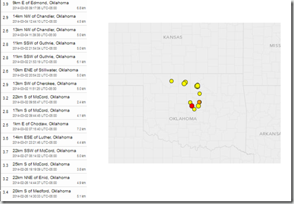
    While most of Oklahoma’s temblors since then have come in under 4.0, on average they’ve seen at least a couple of 2.5+ quakes every day for the past month.  Not strong enough to cause significant damage, but strong enough to be felt, and to raise concerns.


    Today, the USGS is reporting a M3.9 - 9km E of Edmond, Oklahoma, the strongest temblor in that region since February 8th’s M4.1 quake. 


    Earlier this year, the USGS produced the following update, which links the increase in earthquake activity in the Midwest and East to induced seismicity – or man-made causes.

    Man-Made Earthquakes Update

    Categories: Featured, Natural Hazards
    Posted on January 17, 2014 at 1:00 pm
    Last update 2:03 pm By: William Ellsworth (ellsworth@usgs.gov), Jessica Robertson (jrobertson@usgs.gov), and Christopher Hook (703-648-4460)

    Seismicity of the coterminous United States and surrounding regions, 2009–2012. Black dots denote earthquakes with a magnitude ≥ 3.0 are shown; larger dots denote events with a magnitude ≥ 4.0. Background colors indicate earthquake hazard levels from the U.S. National Seismic Hazard Map (NSHM). Learn more about the NSHM at http://earthquake.usgs.gov/hazards/?source=sitenav.

    Seismicity of the coterminous United States and surrounding regions, 2009–2012. Black dots denote earthquakes with a magnitude ≥ 3.0 are shown; larger dots denote events with a magnitude ≥ 4.0. Background colors indicate earthquake hazard levels from the U.S. National Seismic Hazard Map (NSHM). Learn more about the NSHM at http://earthquake.usgs.gov/hazards/?source=sitenav.


    The number of earthquakes has increased dramatically over the past few years within the central and eastern United States. Nearly 450 earthquakes magnitude 3.0 and larger occurred in the four years from 2010-2013, over 100 per year on average, compared with an average rate of 20 earthquakes per year observed from 1970-2000.

    This increase in earthquakes prompts two important questions: Are they natural, or man-made? And what should be done in the future as we address the causes and consequences of these events to reduce associated risks? USGS scientists have been analyzing the changes in the rate of earthquakes as well as the likely causes, and they have some answers.

    USGS scientists have found that at some locations the increase in seismicity coincides with the injection of wastewater in deep disposal wells. Much of this wastewater is a byproduct of oil and gas production and is routinely disposed of by injection into wells specifically designed for this purpose.

    Review Article on Injection-Induced Earthquakes

    U.S. Geological Survey geophysicist William Ellsworth reviewed the issue of injection-induced earthquakes in a July 2013 study published in the journal Science. The article focused on the injection of fluids into deep wells as a common practice for disposal of wastewater, and discusses recent events and key scientific challenges for assessing this hazard and moving forward to reduce associated risks.

    What is Induced Seismicity?

    Although it may seem like science fiction, man-made earthquakes have been a reality for decades. It has long been understood that earthquakes can be induced by impoundment of water in reservoirs, surface and underground mining, withdrawal of fluids and gas from the subsurface, and injection of fluids into underground formations.

    (Continue . . . )

    While the scientific debate over the exact cause of, and best remedy for, this increased seismic activity continues, last October the USGS warned (bolding mine):


    Important to people living in the Oklahoma City region is that earthquake hazard has increased as a result of the swarm. USGS calculates that ground motion probabilities, which relate to potential damage and are the basis for the seismic provisions of building codes, have increased in Oklahoma City as a result of this swarm.  While it’s been known for decades that Oklahoma is "earthquake country," the increased hazard has important implications for residents and businesses in the area.


    Which means that Oklahomans (and anyone else who lives an a seismically active region) need to seriously include earthquake preparedness as part of their overall emergency plans. The State of Oklahoma maintains an earthquake safety webpage at EARTHQUAKE SAFETY,  while additional Oklahoma specific earthquake monitoring and research information can be found at the Oklahoma Geological Survey.


    Although the west coast is most noted for its seismic hazards, much of America’s heartland and parts of the Eastern Seaboard are also susceptible to moderate to strong quakes.   A topic I covered more than a year ago in USGS: Eastern Earthquakes - Rare But Powerful


    image


    At a bare minimum, every household should have a disaster plan, a good first aid kit (and the knowledge to use it), an emergency battery operated NWS weather radio, and emergency supplies to last a minimum of 72 hours during a disaster.To become better prepared as an individual, family, business owner, or community, I would invite you to visit the following preparedness sites.


    FEMA http://www.fema.gov/index.shtm

    READY.GOV http://www.ready.gov/

    AMERICAN RED CROSS http://www.redcross.org/

    For more on increasing your level of preparedness, a partial list of some of my preparedness blogs include:

    When 72 Hours Isn’t Enough

    In An Emergency, Who Has Your Back?

    An Appropriate Level Of Preparedness

    Tuesday, May 06, 2014

    USGS/OGS Joint Statement On Increased Earthquake Threat To Oklahoma

    image

    USGS-OGS Oklahoma Earthquake Activity


    # 8577


    In 2009, after decades of little or no serious seismic activity, the number of earthquakes in Oklahoma began tor rise.  In 2011, a 5.6 Mag Quake Rattled Oklahoma, which was the strongest quake in that state’s history. Since then, the number of quakes has continued to increase, which has been the subject of several blogs here at AFD.


    USGS: Oklahoma Earthquake Swarm Update

    Oklahoma Insurance Commissioner Warns On Earthquake Risks

    USGS: Oklahoma Earthquake Swarm Continues


    While 2013 was a record year for Oklahoma quakes over M3.0, the first 5 months of 2014 have produced quakes at more than twice last year’s rate, leading the USGS and the Oklahoma Geological Survey  (OGS) to issue a joint statement on the ongoing earthquake risk in that state.


    First a link, and a few excerpt from that statement, after which I’ll return with more.


    Record Number of Oklahoma Tremors Raises Possibility of Damaging Earthquakes

    oklahoma-geological-survey Updated USGS-Oklahoma Geological Survey Joint Statement on Oklahoma Earthquakes
    Originally Released: 10/22/2013 1:07:59 PM; Updated May 2, 2014

    The rate of earthquakes in Oklahoma has increased remarkably since October 2013 – by about 50 percent – significantly increasing the chance for a damaging magnitude 5.5 or greater quake in central Oklahoma.

    View map of Oklahoma seismicity.
    View animation of Oklahoma Seismicity.

    A new U.S. Geological Survey and Oklahoma Geological Survey analysis found that 145 earthquakes of magnitude 3.0 or greater occurred in Oklahoma from January 2014 (through May 2; see accompanying graphic). The previous annual record, set in 2013, was 109 earthquakes, while the long-term average earthquake rate, from 1978 to 2008, was just two magnitude 3.0 or larger earthquakes per year. Important to people living in central and north-central Oklahoma is that the likelihood of future, damaging earthquakes has increased as a result of the increased number of small and moderate shocks.

    Oklahoma’s heightened earthquake activity since 2009 includes 20 magnitude 4.0 to 4.8 quakes, plus the largest earthquake in Oklahoma’s history – a magnitude 5.6 earthquake that occurred near Prague on Nov. 5, 2011. The 2011 Prague earthquake damaged a number of homes and the historic Benedictine Hall at St. Gregory's University in Shawnee. Prior to the 2011 Prague earthquake, the largest earthquake of Oklahoma’s history was a magnitude 5.5 earthquake that occurred in 1952 near El Reno and damaged state buildings in Oklahoma City.

    “While it’s been known for decades that Oklahoma is ‘earthquake country’, we hope that this new advisory of increased hazard will become a crucial consideration in earthquake preparedness for residents, schools and businesses in the area,” said Dr. Bill Leith, Senior Science Advisor for Earthquakes and Geologic Hazards at USGS. “Building owners and government officials should have a special concern for older, unreinforced brick structures, which are vulnerable to serious damage during sufficient shaking.”

    (Continue . . .)


    While no specific predictions as to time, location, or intensity are offered, these agencies believe there is a heightened risk for larger, potentially damaging earthquakes in Oklahoma – at least in the near term.


    The bottom line is that Oklahomans (and anyone else who lives an a seismically active region) need to seriously include earthquake preparedness as part of their overall emergency plans.


    The State of Oklahoma maintains an earthquake safety webpage at EARTHQUAKE SAFETY,  while additional Oklahoma specific earthquake monitoring and research information can be found at the Oklahoma Geological Survey.


    Although the west coast is most noted for its seismic hazards, much of America’s heartland and parts of the Eastern Seaboard are also susceptible to moderate to strong quakes.   A topic I covered more than a year ago in USGS: Eastern Earthquakes - Rare But Powerful.


    image


    At a bare minimum, every household should have a disaster plan, a good first aid kit (and the knowledge to use it), an emergency battery operated NWS weather radio, and emergency supplies to last a minimum of 72 hours during a disaster.To become better prepared as an individual, family, business owner, or community, I would invite you to visit the following preparedness sites.

    FEMA http://www.fema.gov/index.shtm

    READY.GOV http://www.ready.gov/

    AMERICAN RED CROSS http://www.redcross.org/


    For more on increasing your level of preparedness, a partial list of some of my preparedness blogs include:

    When 72 Hours Isn’t Enough

    In An Emergency, Who Has Your Back?

    An Appropriate Level Of Preparedness

    Friday, July 18, 2014

    USGS: Updated U.S. Seismic Risk Hazard Maps

    image


    # 8846


    Yesterday the USGS released a 243 page PDF report outlining the revised seismic hazard risks for the United States – their first major update since 2008 – and among its findings it reports a higher risk of strong quakes in the Eastern United States than previously appreciated. 


    Be warned, with hundreds of maps and graphics, this is a very large (113mb) download.


    image


    Documentation for the 2014 Update of the United States National Seismic Hazard Maps

    By Mark D. Petersen, Morgan P. Moschetti, Peter M. Powers, Charles S. Mueller, Kathleen M. Haller, Arthur D. Frankel, Yuehua Zeng, Sanaz Rezaeian, Stephen C. Harmsen, Oliver S. Boyd, Ned Field, Rui Chen, Kenneth S. Rukstales, Nico Luco, Russell L. Wheeler, Robert A. Williams, and Anna H. Olsen
    Abstract

    The national seismic hazard maps for the conterminous United States have been updated to account for new methods, models, and data that have been obtained since the 2008 maps were released (Petersen and others, 2008). The input models are improved from those implemented in 2008 by using new ground motion models that have incorporated about twice as many earthquake strong ground shaking data and by incorporating many additional scientific studies that indicate broader ranges of earthquake source and ground motion models. These time-independent maps are shown for 2-percent and 10-percent probability of exceedance in 50 years for peak horizontal ground acceleration as well as 5-hertz and 1-hertz spectral accelerations with 5-percent damping on a uniform firm rock site condition (760 meters per second shear wave velocity in the upper 30 m, VS30). In this report, the 2014 updated maps are compared with the 2008 version of the maps and indicate changes of plus or minus 20 percent over wide areas, with larger changes locally, caused by the modifications to the seismic source and ground motion inputs.


    Although earthquakes in the Eastern half of the United States have been recorded in the past (including the Charleston, SC earthquake of 1886), the August 2011 5.8 earthquake that rocked Virginia and the Nation’s capital (see USGS Statement On The Virginia Earthquake) provided fresh evidence not only of their potential to occur,  but also how widely felt they may be (see USGS: Eastern Earthquakes - Rare But Powerful).


    Another strong quake a few months later in the Heartland (see 5.6 Mag Quake Rattles Oklahoma), has been followed by hundreds of additional quakes in a region not expected to produce that much seismic activity. 


    Additional earthquake research has turned up new fault lines in California, and perhaps most worrisome of all, found the potential for a much larger quake from the Cascadia Fault in the Pacific Northwest than previously estimated (see Just A Matter Of Time for more on this threat)


    While all 50 states have at least some seismic potential (yes, even Florida), 42 states are viewed as having a reasonable chance of seeing a damaging quake in the next 50 years, and 16 states in particular are considered at highest risk.  The USGS press release states:


    The hazard is especially high along the west coast, intermountain west, and in several active regions of the central and eastern U.S., such as near New Madrid, MO, and near Charleston, SC. The 16 states at highest risk are Alaska, Arkansas, California, Hawaii, Idaho, Illinois, Kentucky, Missouri, Montana, Nevada, Oregon, South Carolina, Tennessee, Utah, Washington, and Wyoming.


    While they acknowledge the risks of man-made earthquakes – due primarily to fracking and injection wells – research into these hazards is just getting started.  The USGS states:


    Induced Earthquakes … Research Underway

    Some states have experienced increased seismicity in the past few years that may be associated with human activities such as the disposal of wastewater in deep wells.

    One specific focus for the future is including an additional layer to these earthquake hazard maps to account for recent potentially triggered earthquakes that occur near some wastewater disposal wells. Injection-induced earthquakes are challenging to incorporate into hazard models because they may not behave like natural earthquakes and their rates change based on man-made activities.


    While it may not be predictive of future events, so far 2014 has provided a major uptick in seismic activity in the United States, and around the globe.  Southern California, Alaska, and California have all reported increased activity (see LA Times Quakes are increasing, but scientists aren't sure what it means).


    Last December, in Dr. Lucy Jones: `Imagine America Without Los Angeles’, we looked at a presentation given by Dr. Jones at the  annual meeting of the American Geophysical Union (held this year in San Francisco),  that emphasized that should the `big one’ hit Southern California, we could literally `lose’ Los Angeles.


    She warned that the damage could be far greater, and last much longer, than most people believe.  While 99 out of 100 modern buildings might remain standing, the (often buried) infrastructure needed to provide water, electricity, internet connectivity, and natural gas – the lifeblood -  to the region could be devastated (see CBS News report).


    If this sounds like hyperbole, in 2010 (see Revised Risk Of `The Big One’ Along San Andreas Fault) we looked at a study that suggested that Southern California may be more overdue for another major quake than previously thought, and in the following year (see Estimating The Economic Impact Of A San Andreas Quake) we looked at a report from the U.S. Bureau of Labor Statistics that endeavored to gauge the crippling impact that a highly feasible (and long overdue) 7.8 magnitude Southern California earthquake would have on jobs and local businesses.

    image

    Download PDF file

    A quake of this magnitude, they estimate, could affect  430,000 businesses and 4.5 million workers and deliver a devastating – and prolonged – blow to the local (and national) economy.


    While attempts at predicting earthquakes have met with little success, we do know that over time, seismically active regions will be hit again and again, and that the only defense is to be prepared for when that happens.


    Seismic threats extend beyond earthquakes, as they encompass volcanic eruptions (see Washington State: Volcano Awareness Month) - and Tsunamis – both of which have the ability to affect both people and property thousands of miles away from the originating event  (see The USGS West Coast Tsunami Scenario Report & East Coast Tsunami Threats).


    Which is why everyone should have a disaster plan, not just those who live in an earthquake zone.


    As a bare minimum, everyone should have a well thought out disaster and family communications plan, along with a good first aid kit, a `bug-out bag’, and sufficient emergency supplies to last at least 72 hours.


    In When 72 Hours Isn’t Enough, I highlighted  a colorful, easy-to-follow, 100 page `survival guide’ released by Los Angeles County, that covers everything from earthquake and tsunami preparedness, to getting ready for a pandemic.

    image

    The guide may be downloaded here (6.5 Mbyte PDF).

    While designed specifically for the nearly 10 million residents of Los Angeles County, this guide would be a valuable asset for anyone interested in preparing for a variety of hazards. And in Los Angeles, the advice is to have emergency supplies (food, water, etc) to last up to 10 days. In my humble opinion, 2-weeks in an earthquake zone isn’t overkill.


    Working to improve earthquake awareness, preparation, and safety is Shakeout.org, which promotes yearly earthquake drills and education around the country (see NPM13: A Whole Lotta Shakeouts Going On).  If you live in one of these seismically active areas, I would encourage you to take part in these yearly drills.

    image

    To become better prepared as an individual, family, business owner, or community to deal with all types of disasters, I would invite you to visit the following preparedness sites.


    FEMA http://www.fema.gov/index.shtm

    READY.GOV http://www.ready.gov/

    AMERICAN RED CROSS http://www.redcross.org/


    And lastly, in NPM13: The Greatest Prep Of All,  I wrote about what I consider to be the most important preparedness step you can take – having, and being,  a disaster buddy.  Cultivating a network of family and friends to whom you can turn for help in a disaster, to who can turn to you for aid,  if they need it.


    Because no matter where you live, its just a matter of time before the next disaster strikes.

    Friday, July 31, 2015

    USGS: New Madrid Simulation Shows Risks For Memphis & Little Rock

    image

    Seismic Hazard Map – Credit USGS


    #10,375


    In 2011 – during the bicentennial of the four great New Madrid earthquakes of 1811-12 – FEMA and other federal agencies mounted the largest National Level Exercise (NLE) to that date, revolving around a catastrophic earthquake occurring in the New Madrid Seismic Zone (NMSZ) that would involve eight Central U.S. States: Alabama, Arkansas, Kentucky, Illinois, Indiana, Mississippi, Missouri, and Tennessee spread across 4 FEMA regions (IV, V, VI, and VII).


    While sparsely populated 200 years ago during the last big seismic event, a similar quake today would endanger millions of people living in the central United States, and likely cause severe economic and social disruption across an even wider area of the nation.


    This National Level Exercise tested initial incident response along with disaster recovery plans. According to FEMA’s NLE fact sheet, the exercise was designed to validate the following capabilities:

    • Communications
    • Critical resource logistics and distribution
    • Mass care (sheltering, feeding and related services)
    • Medical surge
    • Citizen evacuation and shelter-in-place
    • Emergency public information and warning
    • Emergency operations center (EOC) management
    • Long term recovery


    While large quakes in the middle of the country are rare, the USGS, in Earthquake Hazard in the New Madrid Seismic Zone Remains a Concern, warns:

    Continuing Preparedness Needed

    The geologic record of repeated large earthquakes, the historical accounts of the 1811–12 large earthquakes, and the continuing earthquake activity in the area are compelling evidence that the New Madrid region has high earthquake hazard. The preponderance of evidence leads us to conclude that earthquakes can be expected in the future as frequently and as severely as in the past 4,500 years. Such high hazard requires prudent measures such as adequate building codes to protect public safety and ensure the social and economic resilience of the region to future earthquakes.


    Complicating matters, earthquakes in the central and eastern part of the nation are generally felt over a much wider area than those on the west coast, due to differences in their underlying bedrock.  In 2012’s USGS: Eastern Earthquakes - Rare But Powerful, we looked at this phenomenon.


    The following shake map from the USGS shows the areas reporting shaking from two recent quakes, a 6.0 in Central California, and the recent 5.8 Virginia quake. By an incredibly large margin, the smaller eastern quake was felt over a much bigger area.

    image


    All of which serves as prelude to yesterday’s release from the USGS that shows that computer simulations indicate a future New Madrid quake could produce major, prolonged ground shaking in metropolitan areas across several states, including Memphis, TN, Paducah, KY, Evansville, IN, and Little Rock, AR.


    New Simulations of 1811-1812 New Madrid Earthquakes Show Strong and Prolonged Ground Shaking in Memphis and Little Rock

    Released: 7/30/2015 2:00:00 PM

    Computer simulations of earthquake shaking, replicating the quakes that occurred in 1811-1812 in the New Madrid seismic zone (NMSZ), indicate that future large earthquakes there would produce major, prolonged ground shaking. The 1811-1812 events were some of the largest in the United States since its settlement by Europeans, and the NMSZ spans portions of seven states: Illinois, Indiana, Missouri, Arkansas, Kentucky, Tennessee and Mississippi.

    Scientists from the Universidad Nacional Autónoma de México, the U.S. Geological Survey, San Diego State University, AECOM (formerly URS Corporation), and the University of Memphis simulated a set of 20 hypothetical, yet plausible earthquakes located along two currently active faults in the NMSZ. The hypothetical earthquake scenarios range in magnitude from 7.0 to 7.7, and consider various possible epicenters.

    ”Based on our simulations, were the 1811-1812 earthquakes to repeat today, more than 8 million people living and working near the New Madrid seismic zone would experience potentially damaging ground shaking at modified Mercalli intensities ranging from VI to VIII,” said Leonardo Ramirez-Guzman, lead author of the paper that appears in the July 30 edition of the Bulletin of the Seismological Society of America.

    “Strong ground shaking in the greater Memphis metropolitan area could last from 30 seconds to more than 60 seconds, depending on the magnitude and epicenter of a potential seismic event,” said Ramirez-Guzman, a professor at Universidad Nacional Autónoma de México and former USGS contract scientist.

    The simulations also demonstrate the importance of fault rupture directivity (seismic energy focused along the direction of faulting), especially when combined with the wave channeling effects of the Reelfoot rift, a buried, northeast-southwest trending geologic valley in the NMSZ. In particular, future large earthquakes on the approximately 80-mile long NMSZ fault show strong shaking at vibration frequencies that pose a risk for mid-rise to high-rise buildings and tall bridges. This fault is thought to be responsible for the December 16, 1811 magnitude 7-7.7 earthquake. Some of the earthquake simulations showed strong shaking focused to the northeast as far as 100-200 miles away near Paducah, Kentucky and Evansville, Indiana, and to the southwest 150 miles toward Little Rock, Arkansas. An example of this earthquake shaking focusing effect can be seen here.

    While it’s not possible to know which direction a fault will rupture once an earthquake starts, knowing that there is an increased chance of strong shaking along these geologically-defined corridors is a valuable aid in better characterizing seismic hazard and minimizing earthquake risk.

    Earthquakes pose a significant risk to nearly 150 million Americans. The USGS and its partners in the multi-agency National Earthquake Hazard Reduction Program are working to improve earthquake monitoring and reporting capabilities via the USGS Advanced National Seismic System (ANSS). More information about ANSS can be found on the ANSS website.

    caption below

    Peak ground-motion variability for a magnitude 7.7 earthquake. Warmer colors indicate stronger ground motions. The stronger ground motions are extended further northeast and southwest caused by the channeling effect of the Reelfoot rift (RFR) The fault is displayed as a thick black continuous straight line, with the epicenter indicated by the triangle. (high resolution image 1.3 MB)


    From my 10 years of living in the mostly rural Bootheel of Missouri, I know that most local residents are aware of the seismic history of the region, and are – in general – a fairly resilient lot.  As farmers and ranchers, they tend to be a bit more self sufficient than those who live in surrounding cities.


    But as mentioned above, a rupture of the New Madrid fault could have serious effects on cities 100-200 miles away.


    Areas where millions of people live and work in structures that were not designed with earthquake safety in mind, and where severe disruptions of essential services (water, power, EMS) – particularly during the winter – could make life extremely difficult.


    All of which makes participating in this year’s Great Central U.S. Shakeout, and preparing your home and family for an earthquake, all the more important.  Those who live in other seismically active regions (worldwide) will want to visit Shakeout.org for information on your region’s activities.


    image


    For more recent blogs on earthquakes, and earthquake preparedness, you may wish to revisit:


    OSU: Pragmatic Action - Not Fatalism - In Order To Survive The `Big One’
    Shakeout.Org Twitter Chat On Earthquake Preparedness
    USGS/OGS Joint Statement On Increased Earthquake Threat To Oklahoma

    Tuesday, October 22, 2013

    USGS: Oklahoma Earthquake Swarm Continues

    image

      3.5+Mag quakes – Credit USGS 


    # 7887


    Almost 2 years ago, in November of 2011, I wrote about a 5.6 Mag Quake that Rattled Oklahoma.  At the time I noted that the state of Oklahoma had seen an unusual number of earthquakes over the previous couple of years. In 2010, the Oklahoma Geological Survey Observatory recorded 1,047 earthquakes, of which 103 were strong enough to be felt by the public.


    Since that time, Oklahoma’s earthquake swarm has continued, producing more than 200 3.0+ magnitude temblors over the past 4 years.


    Today the USGS, in partnership with the Oklahoma Geological Survey, has released a report on this ongoing swarm, and how it affects the risks for seeing larger quakes in the region.   I’ve excerpted the key message (bolding mine) below:

    Important to people living in the Oklahoma City region is that earthquake hazard has increased as a result of the swarm. USGS calculates that ground motion probabilities, which relate to potential damage and are the basis for the seismic provisions of building codes, have increased in Oklahoma City as a result of this swarm.  While it’s been known for decades that Oklahoma is "earthquake country," the increased hazard has important implications for residents and businesses in the area.


    The full news release follows:


    Earthquake Swarm Continues in Central Oklahoma


    Released: 10/22/2013 1:07:59 PM

    Contact Information:
    U.S. Department of the Interior, U.S. Geological Survey
    Office of Communications and Publishing
    12201 Sunrise Valley Dr, MS 119
    Reston, VA 20192
    Heidi  Koontz 1-click interview
    Phone: 303-202-4763

    In partnership with: Oklahoma Geological Survey

    Since January 2009, more than 200 magnitude 3.0 or greater earthquakes have rattled Central Oklahoma, marking a significant rise in the frequency of these seismic events.


    The U.S. Geological Survey and Oklahoma Geological Survey are conducting collaborative research quantifying the changes in earthquake rate in the Oklahoma City region, assessing the implications of this swarm for large-earthquake hazard, and evaluating possible links between these earthquakes and wastewater disposal related to oil and gas production activities in the region.


    Studies show one to three magnitude 3.0 earthquakes or larger occurred yearly from 1975 to 2008, while the average grew to around 40 earthquakes per year from 2009 to mid-2013.


    "We've statistically analyzed the recent earthquake rate changes and found that they do not seem to be due to typical, random fluctuations in natural seismicity rates," said Bill Leith, USGS seismologist. "These results suggest that significant changes in both the background rate of events and earthquake triggering properties needed to have occurred in order to explain the increases in seismicity. This is in contrast to what is typically observed when modeling natural earthquake swarms."


    The analysis suggests that a contributing factor to the increase in earthquakes triggers may be from activities such as wastewater disposal--a phenomenon known as injection-induced seismicity. The OGS has examined the behavior of the seismicity through the state assessing the optimal fault orientations and stresses within the region of increased seismicity, particularly the unique behavior of the Jones swarm just east of Oklahoma City. The USGS and OGS are now focusing on determining whether evidence exists for such triggering, which is widely viewed as being demonstrated in recent years in Arkansas, Ohio and Colorado.


    This "swarm" includes the largest earthquake ever recorded in Oklahoma, a magnitude 5.6 that occurred near Prague Nov. 5, 2011.  It damaged a number of homes as well as the historic Benedictine Hall at St. Gregory's University, in Shawnee, Okla.  Almost 60 years earlier in1952, a comparable magnitude 5.5, struck El Reno and Oklahoma City. More recently, earthquakes of magnitude 4.4 and 4.2 hit east of Oklahoma City on April 16, 2013, causing objects to fall off shelves.


    Following the earthquakes that occurred near Prague in 2011, the agencies issued a joint statement, focusing on the Prague event and ongoing seismic monitoring in the region.  Since then, the USGS and OGS have continued monitoring and reporting earthquakes, and have also made progress evaluating the significance of the swarm.


    Important to people living in the Oklahoma City region is that earthquake hazard has increased as a result of the swarm. USGS calculates that ground motion probabilities, which relate to potential damage and are the basis for the seismic provisions of building codes, have increased in Oklahoma City as a result of this swarm.  While it’s been known for decades that Oklahoma is "earthquake country," the increased hazard has important implications for residents and businesses in the area.


    To more accurately determine the locations and magnitudes of earthquakes in Oklahoma, the OGS operates a 15-station seismic network.  Data from this system, and from portable seismic stations installed in the Oklahoma City region, are sent in real-time to the USGS National Earthquake Information Center, which provides 24x7 reporting on earthquakes worldwide.


    The State of Oklahoma maintains an earthquake safety webpage at EARTHQUAKE SAFETY,  while additional Oklahoma specific earthquake monitoring and research information can be found at the Oklahoma Geological Survey.


    Although the west coast is most noted for its seismic hazards, America’s heartland and parts of the Eastern Seaboard are susceptible to moderate to strong quakes.   A topic I covered about a year ago in USGS: Eastern Earthquakes - Rare But Powerful


    image


    Given the risks, the United States government devoted their National Level Exercise (NLE 2011) two years ago to a simulated catastrophic earthquake in the New Madrid Seismic Zone (NMSZ).We live on a violent planet, one that is prone to storms, fires, floods, drought, volcanoes, earthquakes and myriad other natural disasters.Emergencies happen every day.


    Disasters, admittedly, less often. But in either event, preparedness is key.


    At a bare minimum, every household should have a disaster plan, a good first aid kit (and the knowledge to use it), an emergency battery operated NWS weather radio, and emergency supplies to last a minimum of 72 hours during a disaster.To become better prepared as an individual, family, business owner, or community, I would invite you to visit the following preparedness sites.

    FEMA http://www.fema.gov/index.shtm

    READY.GOV http://www.ready.gov/

    AMERICAN RED CROSS http://www.redcross.org/


    For more on increasing your level of preparedness, a partial list of some of my preparedness blogs include:

    When 72 Hours Isn’t Enough

    In An Emergency, Who Has Your Back?

    An Appropriate Level Of Preparedness

    Friday, July 05, 2019

    Southern California: Shaken and Hopefully Stirred To Action


    #14,166


    One of the ideas driven home to me by writing this blog over the past 14 years is that all droughts - even good ones - eventually end.  
    • When Category 4 Hurricane Harvey battered and flooded east Texas in 2017, it ended an 11+ year drought in major (CAT 3+) land-falling hurricanes in the Continental United States.
    • When a novel swine-origin H1N1 virus emerged in 2009, it ended a 40 year drought in flu pandemics. 
    As humans, we like to think today will be pretty much like yesterday, and tomorrow will be pretty much like today.  If a disaster, or a pandemic, hasn't happened in a certain area for years or even decades - we tend to ignore or marginalize the risks. 
    A tactic that works wonderfully well until it doesn't anymore. 
    While the threat of another great California earthquake remains easy fodder for disaster movies, California has been in an earthquake drought for over a century, and few can truly imagine the level of seismic activity that state saw in the 1800s.

    Earlier this year, the SSA (Seismological Society of America) held their annual meeting, and a study was presented that concludes that California's recent lack of major quakes has no precedent in the past 1000 years.

    The Current Unlikely Earthquake Hiatus at California’s Transform Boundary Paleoseismic Sites

    Glenn P. Biasi, Katherine M. Scharer

    Seismological Research Letters (2019) 90 (3): 1168-1176.
    https://doi.org/10.1785/0220180244

    ABSTRACT

    Paleoseismic and historical earthquake records used to quantify earthquake recurrence rates can also be used to test the likelihood of seismically quiescent periods. At principal paleoseismic sites in California on the San Andreas, San Jacinto, Elsinore, and Hayward faults, no ground‐rupturing earthquake has occurred in the last 100 yr, yet this interval is about three times the average interearthquake period for the ensemble of sites. 
            (Continue . . . )

    The following SSA news article discusses these findings.

    How to Explain California’s Recent Earthquake Hiatus?


    25 April 2019–There have been no major ground rupturing earthquakes along California’s three highest slip rate faults—the San Andreas, the San Jacinto and the Hayward—in the past 100 years. At the 2019 SSA Annual Meeting, researchers discussed why this “hiatus” might exist, and what we might expect for California earthquakes over the next century.

    (SNIP)

    Researchers can’t predict when earthquake clusters may occur again, she adds, but if clustering is occurring, “it’s likely that we’re going to have a lot of earthquakes when they do start happening again.”

    At the meeting, USGS seismologist Kate Scharer will also present results of a recent study published in the journal Seismological Research Letters on the unlikely nature of the California hiatus. The analysis by Scharer and her USGS colleague Glenn Biasi concludes that the current hiatus has no precedent in the last 1000 years of paleoseismic records along the three major faults.

    They agree that the next 100 years of California earthquakes along these faults could be a busy one. “If our work is correct,” Scharer and Biasi note, the next century isn’t going to be like the last one, but could more like the century that ended in 1918.”

    (Continue . . . )

    Yesterday's M6.4 earthquake in the Mojave desert - which has been followed by nearly 200 M2.5 aftershocks - is a not-so-gentle reminder that the ground beneath our feet isn't as secure as we'd like to believe. 
    Clusters of earthquakes - even moderately strong ones - are not uncommon, however, and most of the time they recede in intensity and frequency over a matter of a few weeks.  
    Hopefully, this latest swarm will follow that path. But history tells us that one of these days - another great quake will strike the West Coast of the United States, and that cities like Los Angeles, San Francisco, and Seattle are all vulnerable to severe damage.

    In 2013, in Dr. Lucy Jones: `Imagine America Without Los Angeles’, we looked at a presentation given  at the annual meeting of the American Geophysical Union (held that year in San Francisco),  that emphasized that should the `big one’ hit Southern California, we could literally `lose’ Los Angeles.
    She warned that the damage could be far greater, and last much longer, than most people believe.  While 99 out of 100 modern buildings might remain standing, the (often buried) infrastructure needed to provide water, electricity, internet connectivity, and natural gas – the lifeblood -  to the region could be devastated (see CBS News report).
    In 2011 (see Estimating The Economic Impact Of A San Andreas Quake) we looked at a report from the U.S. Bureau of Labor Statistics that endeavored to gauge the crippling impact that a highly feasible (and long overdue) 7.8 magnitude Southern California earthquake would have on jobs and local businesses.
    image
    Download PDF file

    A quake of this magnitude, they estimate, could affect  430,000 businesses and 4.5 million workers and deliver a devastating – and prolonged – blow to the local (and national) economy.
    While huge death tolls are considered unlikely in this scenario, the untimely demise of thousands of unprepared businesses is all but assured.
    As a follow up story in the Los Angeles Times pointed out, it is imperative that local businesses prepare now for an inevitable quake. Else they risk not only their own economic future, but the futures of their employees and of the local economy. 
    Southland businesses urged to get ready for 'The Big One' -- a 7.8 earthquake

    June 21, 2011 | 3:03 pm
     
    As the USGS map at the top of this blog shows, it isn't just the West Coast at risk of a massive quake (see  USGS: Nearly Half Of U.S. Population Exposed to Potentially Damaging Earthquakes).
    • Three years ago FEMA and the U.S. government conducted a huge drill (see FEMA: Cascadia Rising 2016)  involving 20,000 people from both the United States and Canada, in order to prepare for a catastrophic M9.0 quake & tsunami off the Pacific coast. 
    • And in 2011 – during the bicentennial of the four great New Madrid earthquakes of 1811-12 – FEMA and other federal agencies mounted the largest National Level Exercise (NLE) to that date, revolving around a catastrophic earthquake occurring in the New Madrid Seismic Zone (NMSZ) that would involve eight Central U.S. States.
    • Perhaps least appreciated is the seismic history of South Carolina, which in 1886 was struck by an  (Est. 7.3-7.6 magnitude) quake that devastated much of Charleston, South Carolina. Shaking was felt as far north as Boston, south to Cuba, and west as far as New Orleans.
    Hopefully the Searles quake swarm will soon recede, but someday another major quake will strike the region. When that day comes, the advantage will go to individuals, families, and businesses who were already prepared. 
    If I lived in a seismic zone, and were not already well prepared, I'd be spending a good deal of time today reviewing my earthquake plan, and making sure I had as many bases covered as possible. 
    For those living in California, the Governor's Office of Emergency Preparedness has an Earthquake Preparedness website set up with information on how best to prepare.
    Whether you live in an earthquake zone, hurricane country, or tornado alley -  every home should be at least minimally prepared to deal with one if it happens.
    So . . . if a disaster struck your region today, and the power went out, stores closed their doors, and water stopped flowing from your kitchen tap for the next 7 to 14 days  . . .  do you already have:
    • A battery operated NWS Emergency Radio to find out what was going on, and to get vital instructions from emergency officials
    • A decent first-aid kit, so that you can treat injuries
    • Enough non-perishable food and water on hand to feed and hydrate your family (including pets) for the duration
    • A way to provide light when the grid is down.
    • A way to cook safely without electricity
    • A way to purify or filter water
    • A way to stay cool (fans) or warm when the power is out.
    • A small supply of cash to use in case credit/debit machines are not working 
    • An emergency plan, including meeting places, emergency out-of-state contact numbers, a disaster buddy,  and in case you must evacuate, a bug-out bag
    • Spare supply of essential prescription medicines that you or your family may need
    • A way to entertain yourself, or your kids, during a prolonged blackout