Showing posts with label Resources. Show all posts

Saturday, July 06, 2013

CDC H3N2v Resources

image 

Credit NASPHV


# 7453


Between MERS-CoV, H7N9, H5N1, and the emerging swine (variant) H3N2v virus, the attentions of public health officials around the globe are focused on multiple emerging viral threats this year.   


While generally viewed as the least `virulent’ of the four – H3N2v infected 309 people (that we know of) in 2012, and displayed signs of limited human-to-human transmission


This year, we have reports of at least 12 infections in Indiana (see Indiana Reports 8 More H3N2v Cases).  Studies suggest (see CID Journal: Estimates Of Human Infection From H3N2v (Jul 2011-Apr 2012)) that a large number of cases may be going unidentified.


On June 28th, the CDC provided the following assessment on this virus’ ability to spread in humans.


CDC will continue to watch this virus closely to make sure there are no changes in the epidemiology of related human infections. That means watching for any changes in the severity of illness caused by infection with this virus and any signs that the virus is becoming more adept at spreading from person-to-person.

Like all influenza viruses, it’s possible that mutations could occur that would allow this virus to become more severe or to spread more easily between people.


The risk of this virus triggering a full-blown pandemic is considered relatively low, however, because serology studies have suggested that significant numbers of adults have some existing immunity against this virus.


Children younger than about 10 years old, however, have little to no immunity against H3N2v virus.


Given this, a more likely scenario if H3N2v were to become more transmissible among people would be localized outbreaks in pockets of the population that do not have immunity against this virus, for example, in day care or school settings.


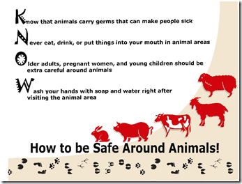
For now, the emphasis is on preventing the spread of infection from swine to humans, to deprive the virus opportunities to better adapt to people.  Accordingly, the CDC has produce a good number of resources (see links below), such as the following poster:


image


A list of resources, and posters (suitable for printing) are available on the following CDC webpage:


Fact Sheet: Protect Yourself Against H3N2v

Resources
Print Materials

Information and materials, including educational posters  [389 KB, 1 page]External Web Site Icon that can be displayed around animal exhibits, are available in Compendium of Measures to Prevent Disease Associated with Animals in Public Settings, 2011External Web Site Icon.

Flyer: Key Facts For People Exhibiting Pigs at Fairs  [640 KB, 2 pages]

Flyer: Take Action to Prevent the Spread of Flu Between People and Pigs at Fairs  [438 KB, 2 pages]

Flyer: Issues for Fair Organizers to Consider When Planning Fairs  [1.4 MB, 2 pages]


Materials from North Carolina Department of Agriculture and Consumer ServicesExternal Web Site Icon:

Reduce Your Risk (English)  [22 KB, 1 page]External Web Site Icon, Reduce Your Risk (Spanish)  [22 KB, 1 page]External Web Site Icon


Materials from Colorado Department of Public Health and EnvironmentExternal Web Site Icon


Signs for Strollers at Fairs [85 KB, 2 pages]External Web Site Icon


Videos

Video Podcast: CDC Recommendations to Reduce the Risk of H3N2v Flu Virus Infection for Fairgoers and Swine Exhibitors [5 MB, 5 min 51 sec]

Dr. Lyn Finelli discusses CDC’s recommendations for reducing the risk of infection with H3N2v flu viruses for fairgoers and swine exhibitors.
Saturday, October 27, 2012

Resources To Follow The Northeast Storm Online


image 

Credit NWS Binghamton,NY


# 6671


Hurricane Sandy is being billed as having the potential to become a major New England storm when it merges with a mid-latitude trough coming in from the west early next week. It is even being compared with the `perfect storm’ of 1991, and so local, state and Federal emergency planners are burning the midnight oil this weekend in preparation.


There is always the possibility that Sandy will prove less damaging than feared, but one can’t simply assume that the Mid-Atlantic and New England states will get lucky.


The internet provides a unique platform for watching Sandy’s trek across Northeastern states, with resources that include live coastal radars, NOAA weather radio broadcasts, streaming radio and TV coverage from cities all across the region,  beach front and traffic webcams and even scanners to listen to local emergency radio traffic.


For those in the path of the storm, or those with friends or family in the affected area, this can help provide valuable information as to what is going on during and after the storm.


And for those who are simply curious as to the impact of this hurricane, this is a convenient way to monitor it.


Disclaimer: These links are offered without warranty or endorsement (except for the NHC & NOAA links), and you visit them at your own risk.


It is always prudent to use up-to-date antivirus software, and decline to install any software from vendors you do not trust, when surfing the net.


Official sources are always your best option, so when it comes to getting the latest information on hurricanes, your first stop should be the National Hurricane Center in Miami, Florida.


These are the real experts, and the only ones you should rely on to track and forecast the storm.


To get their latest forecasts – particularly if the power is out in your area – you really need a battery operated Weather radio. Once thought of as mainly a source of local weather information, it has now become an `All-Hazards' alert system as well.


image


You’ll find that  NOAA Weather Radio All Hazards broadcasts are available online via live streaming audio hosted by other entities, like  Weather Underground. This allows you to listen to broadcasts outside of the range of your receiver.


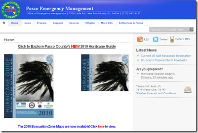
The second official information source you should have bookmarked is your local Office of Emergency Management.  There you will find information about evacuation zones, shelters, and emergency decrees in your area.


If you are on Twitter, you should also follow @FEMA, @CraigatFEMA, @NHC_Atlantic, @NHC_Pacific and @ReadydotGov.


You can access live feeds from the nation’s array of NEXRAD and TDWR radar installations, via this link at Weather Underground.

image


Live beach cams line the coast, and as this screen capture this morning from Kill Devil Hills, NC shows, the weather there is already deteriorating.

image

Raleigh broadcaster WRAL.Com has an interactive map with a number of these cams available.

image

The most extensive list of Northeastern Webcams I’ve found so far is HERE, although one should expect that some  of these will be out of commission as the storm approaches, or slow to load due to heavy internet traffic.


Live streaming radio on the internet has grown remarkably over the past few years, and this site has links to thousands of stations. Choose Radio Stations by State to narrow down your search.


image


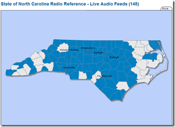
Local, county and state emergency services frequencies (fire, police, EMS) can be assessed via RadioReference.com.  Their interactive maps allows you to first pick a state, and then drill down to the county you are looking for, where you’ll be presented with a list of feeds.


image

With more than 3,300 feeds there’s a pretty good chance you can monitor nearly every place in the country.


Hurricane City, a well known hurricane tracking site and forum, broadcasts on USTREAM when hurricanes approach the coast and you can watch it HERE.


You’ll also find live hurricane coverage and chaser cam footage from Mark Sudduth’s HurricaneTrack.com.


USTREAM, mentioned earlier, provides a venue for all types of broadcasting.  Enter  HURRICANE  or SANDY or FRANKENSTORM  in the search box for a list of current streaming video. You’ll find everything from storm chaser video to live feeds from hotels on the Altantic beaches.


Since anyone can broadcast on USTREAM, accept anything you see or hear cautiously. Still, USTREAM can be a terrific resource.


I’ll try to have more resources later, and will update this blog post if I find anything tonight. But this should give you a pretty good start on following the storm.

Tuesday, December 06, 2011

CDC: Avian Influenza Resource Updates


# 5993


image

H5N1 Virus – Source CDC PHIL 


I’m happy to report that the CDC has updated and/or added a number of avian flu related web pages this week. These resources provide excellent background information along with current thought on the threats posed by avian influenza in birds, humans, and other animals. 


After the links, you’ll find an excerpt from the CDC’s risk assessment of the H5N1 avian flu virus.


As you’ll see, concerns over it’s adaptation to humans have not diminished.


As far as the future of avian flu, and the threat it poses to public health, here is what the CDC has to say:


Assessment of Public Health Threat


As the highly pathogenic avian influenza A (H5N1) epizootic (animal outbreak) is not expected to diminish significantly in the short term, sporadic human infections with H5N1 virus, resulting from direct or close contact with infected sick or dead poultry, are expected to continue to occur, including fatal cases. So far, the spread of H5N1 virus from person-to-person has been very rare, limited, and not sustained.


To date, there is no evidence of genetic reassortment between human influenza A and H5N1 viruses. However, influenza A viruses circulating among poultry have the potential to recombine with human influenza A viruses.


Therefore, this H5N1 epizootic continues to pose an important public health threat. There is little pre-existing natural immunity to H5N1 virus infection in the human population. If H5N1 viruses gain the ability for efficient and sustained transmission among humans, an influenza pandemic could result, with potentially high rates of illness and death worldwide.


Human infection with novel or nonhuman influenza A viruses, including influenza A viruses of animal origin, is a nationally notifiable disease in the United States. Human infections with nonhuman or novel human influenza A virus should be identified quickly and investigated to determine possible sources of exposure, identify additional cases, and to evaluate the possibility of human-to-human transmission.


Friday, August 26, 2011

Monitoring Irene’s Trek Online


# 5788


The internet provides a unique platform for watching Irene’s trek across the mid-Altantic states, with resources that include live coastal radars, NOAA  weather radio broadcasts, streaming radio and TV coverage from cities all across the region,  beach front and traffic webcams and even scanners to listen to local emergency radio traffic.


For those in the path of the storm, or those with friends or family in the affected area, this can help provide valuable information as to what is going on during and after the storm.


And for those who are simply curious as to the impact of this hurricane, this is a convenient way to monitor it.


This afternoon, and probably again later in the weekend, I intend to post some of the web resources I’ll be monitoring as the storm comes ashore. 


Disclaimer: These links are offered without warranty or endorsement (except for the NHC & NOAA links), and you visit them at your own risk

It is always prudent to use up-to-date antivirus software, and decline to install any software from vendors you do not trust, when surfing the net.


The focus today with be on North Carolina, where Irene is expected to make landfall tomorrow morning, but I’ll provide links further up the coast in a later post.


Nearly all of these links are subject to storm related outages and bandwidth limitations, so don’t be surprised if you find some of them offline during the course of the next couple of days.


First stop, of course, is the National Hurricane Center in Miami, Florida that tracks the storm.  You can also visit the Wilmington, NC and Newport/Morehead City, NC National Weather Service Weather Forecast Offices (WFO) for local advisories.


image


Similarly, NOAA Weather Radio All Hazards broadcasts are available online as live streaming audio although they are hosted by other entities, including Weather Underground.


Via Weather Underground we’ve a couple of live radar feeds you can access.  You can just begin to see Irene’s eye in this snapshot taken at 3:00 pm EST today on the Wilmington Radar.

image


A little further north you’ll find the Morehead City radar.

image


Interesting, but often frustrating and requiring patience, are the live streaming webcams scattered across North Carolina. These camera feeds tend to suffer from heavy web traffic, are sometimes poorly maintained, and are prone to going offline when a storm strikes.


Still, there are plenty to choose from, and when you can connect, they can make for interesting viewing.


Raleigh broadcaster WRAL.Com has an interactive map with a number of these cams available.  Fair warning: About half of the ones I checked were not currently accessible.


image


WRAL also has a page with streaming traffic cams from across the state.


Traffic Camera Video tease 540x50

Watch recently captured video from major highways in the Triangle area. Video clips show approximate time that the video was captured. Clips, taken from locations in Wake, Durham and Orange counties, last about 15 seconds are updated about every 4 minutes.


For a list of North Carolina TV stations, some of which will be providing live, 24-hour streaming coverage of Irene’s arrival, you can go to:


North Carolina TV stations


You’ll have to find steaming coverage by trial and error, as some stations may not be streaming.


Live streaming audio is also available from a number of radio stations in North Carolina.  A webpage with links to their websites can be found at:


Streaming Radio Guide


More than 140 local, county and state emergency services frequencies (fire, police, EMS) can be assessed via RadioReference.com.  The interactive maps shows counties with scanner monitoring. Click on the county, and you’ll be presented with a list of feeds.


image


Hurricane City, a well known hurricane tracking site and forum, broadcasts on USTREAM when hurricanes approach the coast and you can watch it HERE.


You’ll also find live hurricane coverage and chaser cam footage from Mark Sudduth’s HurricaneTrack.com.


Emergency Stream provides live, raw, and uncut audio and video feeds from all over the country.  Frankly, there’s no telling what you will find there.  Local TV broadcasts, raw helicopter camera feeds, etc.


 image

Your best option is to select either audio or video feeds, and then the state from the list that appears on the right side of the page. These links are transient, so some channels may be active while others are not. 


Check all of the links, and check back often.


USTREAM, mentioned earlier, provides a venue for all types of broadcasting.  Enter  HURRICANE  or IRENE in the search box for a list of current streaming video. You’ll find everything from storm chaser video to live feeds from hotels on the Altantic beaches.


Since anyone can broadcast on USTREAM, accept anything you see or hear cautiously. Still, USTREAM can be a terrific resource.


I’ll try to have more resources later, and will update this blog post if I find anything tonight. But this should give you a pretty good start on following the storm.

Monday, July 11, 2011

CDC: 2012 Yellow Book Online


# 5684


image


Every two years the CDC publishes their `Yellow Book’, a reference for those who advise international travelers about health risks. While written primarily for Health Care providers, the yellow book is a tremendously valuable resource for all.


You find it chock full of maps, charts, and advice and information on everything from Amebiasis to Yersiniosis, and scores of infectious diseases in-between. 


For those who will refer to it often, a 640 page hard copy is available from the Oxford University Press for $45.00.  You can also order a copy from online booksellers such as Amazon and Barnes & Noble.


But for casual users, or those on a budget, the text of the the 2012 Yellow Book is available online on the CDC’s  Traveler’s Health website.


According to a recent CDC Press release, new to the 2012 edition are:

  • Updated maps on the distribution of dengue, a mosquito-borne disease usually found in the tropics, which has been increasing internationally and was seen in the southern Florida in 2009 for the first time in 75 years.
  • What to expect if you're traveling during an international disease outbreak
  • Larger and more detailed maps for yellow fever and malaria, which can sometimes affect only certain parts of countries.
  • Tips for travel to mass gatherings such as the Hajj pilgrimage and sporting events like Olympics or World Cup
  • Prevention of traveler's diarrhea – it's not only what you eat and drink, but also other factors including how your food is prepared and where you eat.

So, whether you are planning a trip to some exotic locale, or are simply interested in reading about some of the pathogens you might encounter in your travels, the CDC’s Yellow Book makes a terrific resource.


Saturday, June 18, 2011

Online Hurricane Resources


# 5636


Ready.gov reminds us that there are three important steps to preparedness.


image


Luckily the third step – staying informed – gets easier every year as the number of online resources for tracking severe weather improves.


Since the 2011 Atlantic Tropical Storm Season has begun, today I’ve a list of some of my favorite online Hurricane resources. Some of these are `official government’ portals of information, while others are run by hurricane and severe weather enthusiasts.


While some very good information and analysis can be had through non-official channels on the internet, you should only rely on local emergency management officials, the National Hurricane Center, and the National Weather Service for:

  • forecasts
  • warnings
  • evacuation recommendations.


The first stop on our list is the National Hurricane Center in Miami, Florida.  These are the real experts, and the only ones you should rely on to track and forecast the storm.


image


Last year there were some significant changes in how the NHC will advise us on hurricanes.   Some of the (excerpted) highlights include:

Watches and warnings for tropical storms and hurricanes along threatened coastal areas will be issued 12 hours earlier than in previous years.

  • Tropical storm watches will be issued when tropical storm conditions are possible along the coast within 48 hours.
  • Tropical storm warnings will be issued when those conditions are expected within 36 hours. Similar increases in lead-time will apply to hurricane watches and warnings.


The Saffir-Simpson Hurricane Wind Scale will become operational.  The scale keeps the same wind speed ranges as  the original Saffir-Simpson Scale for each of the five hurricane categories, but no longer ties specific storm surge and flooding effects to each category.


The size of the tropical cyclone forecast cone will be adjusted.


The cone represents the probable track of the center of a tropical cyclone, and is formed by enclosing the area swept out by a set of imaginary circles placed along the forecast track (at 12, 24, 36 hours, etc.).  The size of each circle is set so that two-thirds of historical official forecast errors over a 5-year sample fall within the circle.


The circle radii defining the cones in 2010 for the Atlantic and eastern North Pacific basins are given in the table below.


image


The second official information source you should have bookmarked is you local Office of Emergency Management.  Here you’ll be able to access local warnings, flood maps and evacuation information.


To find it, you can Google or Yahoo search with your county/parish name and the words `Emergency Management’.   Below you’ll find a screenshot of the entry page to my county’s page.


image


If you are on Twitter, you should also follow @FEMA, @CraigatFEMA, @NHC_Atlantic, @NHC_Pacific and @ReadydotGov.


The NOAA’s NWS National Hurricane Center in Miami also has a Facebook page, where you can keep up with the latest tropical developments.


image


For those who like to look at satellite imagery (and who doesn’t?), you’ll find a treasure trove of continually updated photos and movie loops at NOAA’s Satellite Imagery page.

image


Beyond the official channels there are resources for those who wish to follow these storm more closely, to participate in online discussions, or who would like independent assessments of storm tracks or movement.


These are not substitutes for the National Hurricane Center’s forecasts or your local office of Emergency Management advisories.


And while some of these sites have some very talented and knowledgeable amateur meteorologists, until you know the players and their track records, you really don’t know who is worth listening to, and who isn’t.


You can learn a lot from the online Hurricane discussion forums, but Caveat Lector when it comes to forecasts and predictions.


The first stop on the unofficial tour is Weather Underground’s Tropical weather page.  This is an extremely comprehensive website, and a good source of global weather information. Here you’ll alos find Dr. Jeff Masters (a co-founder of Weather Underground), who writes his well respected WunderBlog.


For those who like to `look under the hood’, my hometown (Tampa Bay) Fox TV station has a terrific hurricane page, with access to numerous (animated) hurricane forecast models.


For hurricane geeks, this is about as close to weather nirvana as you can get.


image


While there are dozens of other hurricane resource and tracking/discussion sites out there, I’ll just mention a couple I’ve used in the past.


First is Hurricane City, which has been around since 1997, and boasts an active discussion board, up-to-date NHC advisories, and frequent live video broadcasts during the hurricane season via their hurricane TV  channel.


And then there’s storm chaser Mark Sudduth’s Hurricanetrack.com, which also features live video, often from inside the storm.


Both of these sites have free access and paid subscription access levels. I offer these as examples of a genre, but without specific recommendation. Their usefulness to you will depend, quite frankly, upon your level of hurricane geekiness.  They aren’t for everyone.


As hurricane season ramps up, you can expect a fair amount of coverage in this blog as well. 


When a storm threatens a specific region of the coast, I’ll try to provide local resources that you can monitor including radio, TV, and emergency service scanner feeds.


In the meantime, now is the time to get your disaster preparations in order.  Here is some of the information provided by the National Hurricane Center on preparedness.

Be Prepared


"Preventing the loss of life and minimizing the damage to property from hurricanes are responsibilities that are shared by all

."

Hurricane Season: Are You 

Prepared?Throughout this Web site, information has been provided regarding actions that you can take based on specific hurricane hazards. The most important thing that you can do is to be informed and prepared. Disaster prevention includes both being prepared as well as reducing damages (mitigation).

Disaster Prevention should include:

Friday, April 08, 2011

When Spring Has Violently Sprung


# 5476


Last week, when I was on the road to Missouri, a long-lived tornado crossed the state of Florida wreaking havoc and damaging hundreds of homes and businesses.


I was lucky.  I came home to find a large tree branch draped carelessly across my carport roof, and a window screen on my Florida room partially dislodged, but no other damage. 


Spring, for much of the nation, is tornado season.


March, April, May and June generally see the strongest, and most frequent tornadoes, but these violent windstorms can occur any time of the year - particularly in the south


image


All but a small part of the United States is vulnerable to these storms, but the strongest of these storms generally occur in an area we call Tornado Alley (below), which runs from middle Texas north though Oklahoma, Kansas, Nebraska and South Dakota.


image


This is the area where you will generally find the largest and most powerful tornadoes; the F5 wedge type


Fortunately, much of the mid-west is sparsely populated, and so the number of tornado deaths that occur here are actually less than in other areas of the country.   


image


As you can see by the above graphic, severe weather reports for the first three months of 2011 are clustered mostly in the Southeastern states.   


This region, dubbed `Dixie Alley’ actually sees more tornado fatalities in an average year than the more famous `tornado alley’ due to its higher population density, even though the storms tend to be smaller (F1 to F3).


A look at severe weather reports for all of 2010 shows that practically every part of the country saw severe storms (tornado, wind, hail) last year.

image

Which means that everyone should already have an emergency plan in place, have a battery-operated weather radio, and be prepared to seek shelter immediately should conditions threaten.


Whether you are in the path of a storm, or merely fascinated by severe weather, the internet provides many ways to track severe storms. Today I thought I’d share a few of my favorites.


The first stop should always be NOAA’s  Storms Prediction Center, where multi-day outlooks of severe weather are constantly being updated.


Severe (non-tropical) weather is monitored daily by the Storms Prediction Center in Norman, Oklahoma.  On their website you will find the current and forecasted areas of severe weather.


image

Potential for severe weather today (April 8th, 2011) as forecast by the Storms Prediction Center in Norman, Oklahoma.


While today appears to relatively quiet, by Sunday the picture changes in the upper Midwest, where a moderate threat is forecast three days from now.  


image


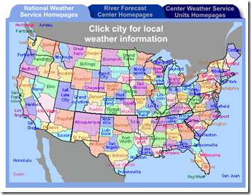
A clickable U.S. map that will link you to the regional NOAA weather forecast offices can be found here, or by clicking the graphic below.


image


image

Another resource is NOAA WEATHER RADIO.


Once thought of as mainly a source of local weather information, it has now become an `All-Hazards' alert system as well.


In order to receive these broadcasts, you need a special receiver.  Many of these radios have a special `Tone Alert', and will begin playing once they receive a special alert signal from the broadcaster.


Like having an emergency kit, a first aid kit, and a portable AM/FM radio - having a weather radio is an important part of being prepared. 


Although not a substitute for having your own emergency weather radio, you can listen to NOAA weather radio alerts online, coming from most areas of the country.


image


When a tornado or severe storm warning has been issued, I will sometimes check to see if local TV stations in the threat area are broadcasting live on the Internet. Cities with a long history of severe storms often break into regular programming for with non-stop coverage. 


A Google Search will often provide you with several local TV stations that may be streaming video.   KFOR.COM in Oklahoma City usually goes live once tornado warnings are issued.  Other stations you might try in the OKC area are KOCO.COM  and KWTV.COM.


If streaming video is a bit too much for your internet connection, you might prefer to listen in to one of the hundreds of police/fire/EMS scanner feeds that are available online. 


RadioReference is just one of several online portals for scanner feeds, but is the one I tend to use.  Simply click on the maps to select the state, then county, that you wish to monitor.


image


But if your internet connection can handle it, you might find the live streaming video (and sometimes audio) from storm chasers in the field to be of interest.  Once again there are several options here. 


One of the biggest is Severe Studios, which often has more than a half dozen chasers streaming video simultaneously.


image


You may also wish to check out Storm Chaser TV, and often you’ll find Hurricane City’s live feed available on their site, or on USTREAM.


Of course, if you are in the path of the storm, you need to get off the Internet and down into your cellar or safe room.  Hopefully today’s threat will turn out to be less serious than the forecast indicates.


For more information on how to prepare for emergencies, including severe weather, the following sites should be of assistance.


FEMA http://www.fema.gov/index.shtm

READY.GOV http://www.ready.gov/

AMERICAN RED CROSS http://www.redcross.org/


When Hurricane season arrives, I’ll have some hurricane-centric links for you as well.

Thursday, July 22, 2010

The Amazing Growth Of New Media


# 4743


At the urging of a friend, a little over 18 months ago, I cast aside my reservations and created a twitter account under my nom de plume @Fla_Medic .  


Admittedly, in those first few weeks, I had no idea what Twitter was all about, or how useful it would end up being for me.  


It seemed so  . . . limited  at first.  Particularly when messages could only be 140 characters or less.


But over time I discovered just how powerful a tool twitter could be. 


I’m not alone.   Many government agencies have embraced Twitter, and other forms of `new media’ (videos, blogs, social media sites) with a passion.


If you aren’t familiar with twitter, a brief explanation might help.


I use a browser add-on that gives me a live `twitter column' running down the right hand side of my screen, and I get tweets (short, micro-bursts of information) from people and agencies I follow updated every 5 minutes as I surf, write, or work on the web.

image

My Firefox browser with twitter add-on.

Some users go to the Twitter.com website for updates, while others use standalone applications.  There are dozens of ways to access your twitter account, including from your smart phone, iPad or ITouch when you are away from your desk.


The secret to making Twitter useful (IMHO) is being selective about who you follow.  Personally, I would find it difficult to pay attention to more than 100-150 accounts, and still get my work done.


Which means that I try to follow only those accounts that provide interesting or useful content.   Currently, I’m `following’ 136 people and/or agencies. 


The rap against Twitter has often been over the quality of information you get from it. As I wrote in It Depends Who You Follow more than a year ago:


What you get out of Twitter (or any social media) depends on who you follow.


With Twitter, you decide whose feeds you will monitor.   If you elect to `follow’ idiots, you will receive idiotic feeds.   If you follow `panic mongers’, you will get panic `tweets’.


Twitter is simply a tool.   Blaming Twitter for spreading panic is like blaming the telephone for spreading malicious gossip.

So I only follow friends and colleagues, a handful of reliable news services, writers I respect, and several dozen governmental and non-governmental agencies.


In return I get a steady stream of useful `tweets’ 24/7  from known-to-be reliable sources that keep me informed, entertained, and often serve as a muse for my writing.


I  usually only `tweet’  5 to 10 times a day.  

Announcing when I post a new blog, or highlighting a someone else’s blog or news story, or `re-tweeting’  a message from another account I think some of my followers would find of interest.


While I don’t follow all of their accounts, one of the big players on Twitter is the US government;  some of their higher profile accounts include @Flugov ,@FEMA, @CDCemergency, and @ReadydotGov


But those just scratch the surface.


The HHS alone has more than 60 twitter accounts, and that number appears to be growing.   


Twitter . . . along with Facebook, YouTube, and other new media sites are fast becoming the preferred method of information dissemination and communication.


The HHS maintains a website devoted to their use of new media.

image


There you will find links to:


Admittedly, I was a bit of a skeptic 18 months ago when I first opened my twitter account.  But since then, it has become an indispensible real-time link to the events, people, and things I am interested in.


Some my other blog posts on social media you may wish to explore include:


Social Media Resources For This Year’s Hurricane Season
CDC Uses Social Media To Spread Swine Flu Information
HHS Unveils New Media Website


Just a few of the science writers/bloggers/Resources (listed in no particularly order) on Twitter that  I can heartily recommend include:


 Crof Crawford Kilian | North Vancouver BC


 marynmck  Maryn McKenna | MSP, ATL, BGR, CDG


 profvrr Vincent Racaniello | NYC


 CIDRAP Minneapolis, MN


 maggiemfox Maggie Fox | Washington


Helen Branswell CP_Branswell  Helen Branswell


 FluTrackers FluTrackers.com | International Website


 David_Dobbs  David Dobbs | Vermont and London


scottwmcpherson  Scott McPherson | Tallahassee, FL

 iayork   Ian York


 JohnDSolomon new york city


 break_glass Jimmy Jazz | Philadelphia, PA


 AndrewPWilson Andrew Wilson | Columbia, MD


 DemFromCT Greg Dworkin


 Dutchy123 Dutchy | Netherlands