Showing posts with label Tropics. Show all posts

Wednesday, August 20, 2014

NHC: Watching The Tropics

image

NHC 5 Day Experimental Outlook


# 8979


With the caveat that this is 5-day experimental outlook, and that it is far to early in the game to begin thinking about what areas of the United States might be impacted, the National Hurricane Center has nonetheless increased the odds that a disturbance now approaching the Windward Islands will organize into a tropical cyclone to 60% over the next 5 days.


TROPICAL WEATHER OUTLOOK

NWS NATIONAL HURRICANE CENTER MIAMI FL
200 PM EDT WED AUG 20 2014

For the North Atlantic...Caribbean Sea and the Gulf of Mexico:

1. Shower and thunderstorm activity associated with an elongated area of low pressure located several hundred miles east of the Windward Islands has become a little better organized during the past few hours. Additional slow development of this system is possible during the next day or two, and a tropical depression could form as the system moves west-northwestward at 10 to 15 mph across the Lesser Antilles and into the Caribbean Sea. After that time, land interaction could limit development potential over the weekend.

Regardless of tropical cyclone formation, gusty winds and heavy rainfall are possible across portions of the Lesser Antilles, Puerto Rico, and the Virgin Islands on Thursday night and Friday. Interests in those islands should closely monitor the progress of this system. An Air Force Reserve Hurricane Hunter aircraft is scheduled to investigate this system tomorrow afternoon, if necessary. * Formation chance through 48 hours...medium...50 percent. * Formation chance through 5 days...high...60 percent.


While we’ve seen a very slow start to the 2014 Atlantic tropical season, we are only a couple of weeks away from the traditional `peak’ of  Hurricane season,  which means this is the time of year we need to be keeping a `weather eye’ on the tropics.


Although this system won’t pose a threat to the continental United States until at least sometime next week (assuming it does, at all) - if you live in Florida, or anywhere along the Gulf Coast – it is never too early to be thinking about your hurricane preparedness plans.


Interests in the Caribbean, of course, could be impacted much sooner - perhaps later this week or over the weekend. Although there are some early model runs suggesting a likely `path’ for this system, they are of only limited value before a tropical cyclone actually forms, and can easily lull one into complacency.


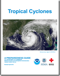
If you haven’t already downloaded the updated Tropical Cyclone Preparedness Guide, now would be an excellent time to do so.
image

NOAA’s NWS National Hurricane Center in Miami are the real experts in hurricane forecasting, and the only ones you should trust. They also have a Facebook page, where you can keep up with the latest tropical developments.

For additional official information you should bookmark your local Office of Emergency Management.  Here you’ll be able to access local warnings, flood maps and evacuation information. To find your local one, you can Google or Yahoo search with your county/parish name and the words `Emergency Management’.  


If you are on Twitter, you should also follow @FEMA, @CraigatFEMA, @NHC_Atlantic, @NHC_Pacific and @ReadyGov

And lastly, a shortcut to my `How To Prepare For Hurricane Season’ post for 2014: Hurricane Preparedness Week: Make A Plan

Tuesday, July 01, 2014

Watching The Tropics

image


# 8796


While it may not currently look like much on radar or In the satellite photos - a low pressure area that slipped off the South Carolina coastline a few days ago and drifted south over the Gulf Stream  - has now gathered steam, and overnight was declared the first tropical depression of the 2014 Atlantic Hurricane Season.


From National Hurricane Center’s  5am discussion:

Numerical guidance shows favorable conditions for intensification with weak shear and developing upper-level outflow over the cyclone during the next 72 hours or so. The official intensity forecast now shows the system becoming a hurricane, which is similar to the latest intensity model consensus.


By the time this system reaches the Outer Banks of North Carolina, it could be a Category 1 hurricane. Here is the NHC’s Tropical Storm Force Wind Speed Probabilities over the next 120 hours.   As you can see, most of heaviest winds are forecast to stay offshore.

image


Nonetheless, this storm has the potential to create life-threatening conditions along the coast, and a Tropical Storm Watch is in effect for the East Coast of Florida from Fort Piece to Flagler Beach.  Watches and warnings will likely be extended northward over the next day or two.


While not likely to be a major storm, the forecasting of future intensity changes in tropical systems remains a big challenge. So anyone in its potential path should take the time today to review their hurricane preparedness plans and supplies, with an eye towards such issues as:


  1. How you will communicate with family & friends during and after a disaster, and where you will meet if you are separated
  2. How you will deal with those with specific needs, such as children, the elderly, or those with medical conditions
  3. To stockpile ample water, food, any required Rx meds, along with a first aid kit
  4. How you will cook, or provide light, or receive emergency radio transmissions if the power is out for days or longer
  5. Where you will go if you are told to evacuate – and how you will get there
  6. And last, but certainly not least, how you will care for your pets during and after a disaster.

Last month, in Hurricane Preparedness Week: Make A Plan, we discussed these issues.  For more information, Ready.gov has an extensive Hurricane preparedness website, with advice on what to do before, during, and after the storm.

image


If you haven’t already downloaded the updated Tropical Cyclone Preparedness Guide, now would be an excellent time to do so.

image

When it comes to getting the latest information on hurricanes, your first stop should always be the National Hurricane Center in Miami, Florida. These are the real pros, and the only ones you should rely on to track and forecast the storm.

  • Tropical storm watches will be issued when tropical storm conditions are possible along the coast within 48 hours.
  • Tropical storm warnings will be issued when those conditions are expected within 36 hours. Similar increases in lead-time will apply to hurricane watches and warnings.

NOAA’s NWS National Hurricane Center in Miami also has a Facebook page, where you can keep up with the latest tropical developments.

The second official information source you should have bookmarked is your local Office of Emergency Management.  Here you’ll be able to access local warnings, flood maps and evacuation information. To find your local one, you can Google or Yahoo search with your county/parish name and the words `Emergency Management’.  

And lastly, if you are on Twitter, you should also follow @FEMA, @CraigatFEMA, @NHC_Atlantic, @NHC_Pacific and @ReadyGov.

Monday, July 08, 2013

Watching The Tropics


image


# 7458


Although it doesn’t currently pose a threat to the U.S. mainland, Tropical Storm Chantal formed overnight about 1200 km to the ESE of Barbados, and is moving rapidly (26 MPH) towards the West.


The National Hurricane Center (NHC) should always be your primary source of information on tropical threats. In addition to visiting their website, they issue alert via  two Twitter accounts, one for the Atlantic basin (which includes the Gulf of Mexico and the Caribbean Sea):

Follow NHC_Atlantic on Twitter U.S. National Hurricane Center (Atlantic) - @NHC_Atlantic

and one for the Eastern North Pacific basin:

Follow NHC_Pacific on Twitter U.S. National Hurricane Center (Eastern Pacific) - @NHC_Pacific

In addition to the Twitter notifications, NHC also provides product notifications by email. Please visit hurricanes.gov/signup.shtml to sign up for this service.

And if you aren’t already following

FEMA

CraigAtFEMA

Ready.gov

Red Cross

on twitter, you might want to add them to your list.


Here is the latest advisory from the NHC.


BULLETIN


TROPICAL STORM CHANTAL INTERMEDIATE ADVISORY NUMBER   2A


NWS NATIONAL HURRICANE CENTER MIAMI FL       AL032013
800 AM AST MON JUL 08 2013

...CHANTAL MOVING QUICKLY TOWARD THE LESSER ANTILLES...

SUMMARY OF 800 AM AST...1200 UTC...INFORMATION
----------------------------------------------
LOCATION...10.6N 50.6W
ABOUT 630 MI...1010 KM ESE OF BARBADOS
MAXIMUM SUSTAINED WINDS...40 MPH...65 KM/H
PRESENT MOVEMENT...W OR 280 DEGREES AT 26 MPH...43 KM/H
MINIMUM CENTRAL PRESSURE...1007 MB...29.74 INCHES

WATCHES AND WARNINGS
--------------------
CHANGES WITH THIS ADVISORY...

NONE.

SUMMARY OF WATCHES AND WARNINGS IN EFFECT...

A TROPICAL STORM WARNING IS IN EFFECT FOR...
* BARBADOS
* DOMINICA
* SAINT LUCIA
* MARTINIQUE
* GUADELOUPE

A TROPICAL STORM WATCH IS IN EFFECT FOR...
* SAINT VINCENT

A TROPICAL STORM WARNING MEANS THAT TROPICAL STORM CONDITIONS ARE
EXPECTED SOMEWHERE WITHIN THE WARNING AREA...IN THIS CASE WITHIN
24 TO 36 HOURS.

A TROPICAL STORM WATCH MEANS THAT TROPICAL STORM CONDITIONS ARE
POSSIBLE SOMEWHERE IN THE WATCH AREA...IN THIS CASE WITHIN 24 HOURS.

INTERESTS ELSEWHERE IN THE EASTERN CARIBBEAN SHOULD MONITOR THE
PROGRESS OF CHANTAL.

FOR STORM INFORMATION SPECIFIC TO YOUR AREA...PLEASE MONITOR
PRODUCTS ISSUED BY YOUR NATIONAL METEOROLOGICAL SERVICE.

DISCUSSION AND 48-HOUR OUTLOOK
------------------------------
AT 800 AM AST...1200 UTC...THE CENTER OF TROPICAL STORM CHANTAL WAS
LOCATED NEAR LATITUDE 10.6 NORTH...LONGITUDE 50.6 WEST. CHANTAL IS
MOVING TOWARD THE WEST NEAR 26 MPH...43 KM/H...AND A WEST-
NORTHWESTWARD MOTION AT ABOUT THE SAME FORWARD SPEED IS EXPECTED
OVER THE NEXT COUPLE OF DAYS.  ON THE FORECAST TRACK...THE CENTER
OF CHANTAL SHOULD REACH THE LESSER ANTILLES EARLY TUESDAY...AND MOVE
INTO THE EASTERN CARIBBEAN SEA LATER ON TUESDAY.

MAXIMUM SUSTAINED WINDS REMAIN NEAR 40 MPH...65 KM/H...WITH HIGHER
GUSTS.  SOME INCREASE IN STRENGTH IS FORECAST DURING THE NEXT 48
HOURS.

TROPICAL-STORM-FORCE WINDS EXTEND OUTWARD UP TO 60 MILES...95 KM
FROM THE CENTER.

THE ESTIMATED MINIMUM CENTRAL PRESSURE IS 1007 MB...29.74 INCHES.

HAZARDS AFFECTING LAND
----------------------
WIND...TROPICAL STORM CONDITIONS ARE EXPECTED WITHIN THE WARNING
AREA BY EARLY TUESDAY.  TROPICAL STORM CONDITIONS ARE POSSIBLE IN
THE WATCH AREA BY EARLY TUESDAY.

RAINFALL...CHANTAL IS EXPECTED TO PRODUCE RAIN ACCUMULATIONS OF 2 TO
4 INCHES OVER THE LEEWARD AND WINDWARD ISLANDS...WITH MAXIMUM
AMOUNTS OF 6 INCHES POSSIBLE.

Friday, June 22, 2012

Watching The Gulf Of Mexico This Weekend


# 6399


For a year that has been predicted to have near-normal tropical activity (see NOAA: `Near Normal’ Hurricane Season Predicted), the Atlantic basin has gotten off to a pretty fast start.


The month of May saw the formation of two pre-season tropical storms (Alberto & Beryl). While Alberto stayed out to seas, Beryl paid a visit to northeastern Florida and southeastern Georgia.  Hurricane (now demoted to a tropical storm) Chris has been meandering across the high latitudes of the Altantic over the past week, affecting only shipping.


Now, barely into the third week June, forecasters at the National Hurricane Center are watching an area just off the Yucatan peninsula that they give a high chance of becoming the 4th named storm of this very young tropical season.


image


TROPICAL WEATHER OUTLOOK
NWS NATIONAL HURRICANE CENTER MIAMI FL
200 AM EDT FRI JUN 22 2012

SHOWER ACTIVITY ASSOCIATED WITH A LARGE LOW PRESSURE SYSTEM LOCATED JUST NORTH OF THE YUCATAN PENINSULA IS CURRENTLY DISORGANIZED.
HOWEVER...THE CIRCULATION IS BECOMING BETTER DEFINED AND SURFACE PRESSURES ARE FALLING ACROSS THE AREA.  ENVIRONMENTALCONDITIONS ARE EXPECTED TO BECOME CONDUCIVE FOR A TROPICALDEPRESSION TO FORM DURING THE NEXT DAY OR SO. THIS SYSTEM HAS A HIGH CHANCE...70 PERCENT...OF BECOMING A TROPICAL CYCLONE DURING THE NEXT 48 HOURS. INTERESTS ALONG THE ENTIRE UNITED STATES GULF COAST SHOULD MONITOR THE PROGRESS OF THIS DISTURBANCE THROUGH THE WEEKEND. HEAVY RAINS AND LOCALIZED FLOODING ARE POSSIBLE ACROSS THE YUCATAN PENINSULA...WESTERN CUBA...AND SOUTHERN FLORIDA THROUGH SATURDAY. AN AIR FORCE RESERVE RECONNAISSANCE AIRCRAFT IS SCHEDULED TO INVESTIGATE THE SYSTEM THIS AFTERNOON...IF NECESSARY.


Forecast models at this stage of the game – before a well defined center of circulation forms – are usually pretty vague, and not terribly reliable. As you can see by this morning’s computer runs, everyone from Texas to Florida needs to keep an eye on this system.


image

Credit SWFTMD


Intensity models are even more problematic, but there is ample heat energy in the warm gulf waters to feed a respectable tropical storm or even a hurricane.


All of which means that residents all along the gulf coast need to be examining their hurricane preparedness plans while they keep their eye on this system.


image


Over the last month I’ve run a number of Hurricane preparedness blogs in concert with National Hurricane Preparedness Week.  You may wish to revisit one of the following as you review your own preparations.


Prepping For Pets
Hurricane Preparedness Week: Taking Action
Hurricane Preparedness Week: Inland Flooding
Storm Surge Monday


For the latest tropical updates, visit the National Hurricane Center website. You can also follow the NHC on twitter at @NHC_Atlantic.

Friday, May 25, 2012

Not Exactly A Beryl Of Fun


# 6345


It isn’t even the first of June, the official start of the Atlantic Hurricane Season, and already forecasters are watching a second area of disturbed weather with the potential to become a named storm.


Earlier this month, Tropical Storm Alberto formed briefly off the South Carolina coast.


This morning, forecasters at the NHC are giving an area of disturbed weather a 70% chance of developing into a tropical system over the next 48 hours. 


Should that happen, it would be christened `BERYL’.


image

SPECIAL TROPICAL WEATHER OUTLOOK
NWS NATIONAL HURRICANE CENTER MIAMI FL
425 AM EDT FRI MAY 25 2012

FOR THE NORTH ATLANTIC...CARIBBEAN SEA AND THE GULF OF MEXICO...

A BROAD AREA OF LOW PRESSURE LOCATED NEAR THE NORTHWESTERN BAHAMAS IS PRODUCING AN EXTENSIVE AREA OF SHOWERS AND THUNDERSTORMS OVER THE BAHAMAS AND CUBA.  WHILE THE ORGANIZATION OF THIS SYSTEM HAS NOT IMPROVED OVER THE PAST FEW  HOURS... ENVIRONMENTAL CONDITIONS ARE EXPECTED TO BECOME MORE CONDUCIVE FOR THE FORMATION OF A SUBTROPICAL OR TROPICAL CYCLONE BY SATURDAY OR SUNDAY.  THE LOW SHOULD MOVE TOWARD THE NORTHEAST AT ABOUT 15 MPH DURING THE NEXT DAY OR SO...FOLLOWED BY A GRADUAL TURN BACK TOWARD THE WEST ON SATURDAY.  THIS SYSTEM HAS A HIGH CHANCE...70 PERCENT... OF BECOMING A TROPICAL OR SUBTROPICAL CYCLONE DURING THE NEXT 48 HOURS.


LOCALLY HEAVY RAINFALL...FLOODING...AND GUSTY WINDS ARE POSSIBLE TODAY OVER PORTIONS OF THE NORTHWESTERN AND CENTRAL BAHAMAS...AS
WELL AS CENTRAL CUBA. INTERESTS ALONG THE SOUTHEASTERN UNITED STATES COAST SHOULD CLOSELY MONITOR THE PROGRESS OF THIS SYSTEM
OVER THE MEMORIAL DAY WEEKEND.  ANOTHER SPECIAL TROPICAL WEATHER OUTLOOK FOR THIS SYSTEM WILL BE ISSUED LATER TODAY.  FOR ADDITIONAL INFORMATION ON THIS SYSTEM...PLEASE SEE HIGH SEAS FORECASTS ISSUED BY THE NATIONAL WEATHER SERVICE...AND PRODUCTS FROM YOUR LOCAL WEATHER OFFICE.

ELSEWHERE...TROPICAL CYCLONE FORMATION IS NOT EXPECTED DURING THE NEXT 48 HOURS.


While off-season tropical storms and depressions are not uncommon, these systems only rarely achieve hurricane status.


The last time that happened was in December of 2005, with long-lasting Hurricane Epsilon. Since then, we’ve seen 6 off-season tropical systems form of less than hurricane strength.


All of this serves as a reminder that storms don’t read calendars, and that it pays to be prepared all year-round.


Next week kicks off National Hurricane Preparedness Week, but today isn’t too soon to talk about preparing.  This reminder from today’s FEMA Blog.


FEMA Urges Preparedness for Hurricanes and Severe Weather

Mobile wireless emergency alerting capabilities will be available nationwide through participating carriers

Release Date: May 24, 2012

FEMA urges individuals and businesses to take action to prepare themselves in advance of severe weather and hurricanes such as taking the pledge to prepare at www.ready.gov/pledge.  This is the first step in making sure  you and your family are ready for an emergency  This includes filling out your family communications plan that you can email to yourself, assembling an emergency kit , keeping important papers and valuables in a safe place, and getting involved.


With the start of hurricanes season it is even more important to know your risk, take action, and be an example. While hurricanes often offer some warning that a threat is approaching, severe weather can occur at anytime and in any place, including high winds, inland flooding, severe storms and tornadoes. 

(Continue . . .)

Sunday, February 05, 2012

An Off-Season Reminder


image

Photo – GOES Weather Loop 2/5/12


# 6122


The Atlantic Hurricane season runs from June 1st through the end of November, but over the years we’ve seen a number of off-season tropical weather systems develop – albeit rarely in February or March.


Today, NOAA has their eyes on a disturbance off the western tip of Cuba that has a slim possibility of intensifying before it reaches Florida.


Early models drag it up and across the peninsula of Florida over the next couple of days, bringing with it some much needed precipitation. 


image

Model Credit – SWFTMD

There appears to be very little chance that this system will amount to much, but history records at least one February Tropical storm.; the famous Groundhog Day storm of 1952.

image

Photo Credit –Wikipedia


Sporting winds of 50 MPH when this system came ashore near Cape Sable, it did little damage, but surprised a lot of folks with its offseason arrival.


While not of tropical origin, the far more destructive `Super storm’ of March 1993 brought a 10 foot surge tide out of the Gulf of Mexico, pushed by hurricane force winds that battered the coast for 12 hours.  


image


As it raked up the eastern seaboard it dumped record amounts of snow from the Florida Panhandle to New England. Along the way it claimed more than 300 lives and inflicted more than $6 billion dollars in damage.


That storm is a vivid memory for me, as it saw me spending 12 very tense and cold hours aboard my 32-foot sailboat, trying to keep her from being damaged or sunk as the winds and tides battered us.


A not-so-gentle reminder that disasters can occur with little or no warning, and that severe storms can show up even when the calendar says they shouldn’t.


Preparedness is truly a year-round responsibility.


For more information on how to prepare for disasters or emergencies, the following sites should be of assistance.

FEMA http://www.fema.gov/index.shtm

READY.GOV http://www.ready.gov/

AMERICAN RED CROSS http://www.redcross.org/


A few of my preparedness blogs you might wish to revisit including:


When 72 Hours Isn’t Enough

In An Emergency, Who Has Your Back?

An Appropriate Level Of Preparedness

The Gift Of Preparedness 2011


In the meantime, it will be interesting to see if this little-storm-that-could turns into anything more than the answer to some future meteorological trivia question.

Friday, August 12, 2011

The Tropics Awaken


# 5752


image


Although the first two months of the 2011 Atlantic Hurricane season has seen a fair amount of activity, with the exception of a weak tropical storm (Don) that crossed the Texas coast in late July, the United States has been spared.


From mid-August on the tropical threat grows, and so we watch tropical waves as they come off the African coast with particular interest. Every hurricane season 100 or more of these systems move across the Atlantic, and some small percentage of those turn into tropical cyclones.


Today, two such systems are moving out of the Cape Verde basin – long known as the birth place for some of the the strongest, and longest lived hurricanes.  Both have a medium chance of developing into a tropical cyclone.


The following comes from today’s 8am Tropical Weather Outlook from the NHC.


1. AN AREA OF LOW PRESSURE CENTERED ABOUT 1175 MILES EAST OF THE NORTHERN LEEWARD ISLANDS IS MOVING WEST-NORTHWESTWARD AT NEAR 20 MPH. SHOWERS AND THUNDERSTORMS HAVE BECOME A LITTLE BETTER ORGANIZED...AND ENVIRONMENTAL CONDITIONS ARE GRADUALLY BECOMING MORE CONDUCIVE FOR DEVELOPMENT. THIS SYSTEM HAS A MEDIUM CHANCE...40 PERCENT...OF BECOMING A TROPICAL CYCLONE DURING THE NEXT 48 HOURS.


Behind this system, and just recently moving off the coast of Africa, we have a 2nd Cape Verde disturbance.


2. A BROAD LOW PRESSURE SYSTEM LOCATED ABOUT 450 MILES SOUTHWEST OF THE SOUTHERN CAPE VERDE ISLANDS IS PRODUCING A LARGE AREA OF CLOUDINESS AND SCATTERED SHOWERS.  ENVIRONMENTAL CONDITIONS ARE EXPECTED TO GRADUALLY BECOME MORE CONDUCIVE FOR DEVELOPMENT OVER THE NEXT SEVERAL DAYS AS IT MOVES WESTWARD AT 15 TO 20 MPH.  THIS SYSTEM HAS A MEDIUM CHANCE...40 PERCENT...OF BECOMING A TROPICAL CYCLONE DURING THE NEXT 48 HOURS.


The NHC is also watching two other areas for possible development (# 3 & #4 on the map). 


Whether any of these systems develop, or ever pose a threat to land, remains to be seen. But for the next 60-90 days the tropics will be at their most active, and so it makes sense to keep a weather eye on the horizon.


image

Photo Credit- NOAA 


The National Hurricane Center website should always be your primary source of information, but if you are on Twitter, you should also follow @FEMA, @CraigatFEMA, @NHC_Atlantic, @NHC_Pacific and @ReadydotGov for the latest Emergency information.


And if you’ve not completed (or recently reviewed) your emergency plan and preparations, now would  be an excellent time to do so.