Showing posts with label Tsunami. Show all posts

Monday, March 23, 2015

Tsunami Preparedness Week - 2015

image


# 9854


Since they don’t happen very often, the threats from great earthquakes, volcanic eruptions, and tsunamis are often under appreciated, particularly in North America and Europe. 


Yet history is replete with accounts of devastating seismic events in such seemingly unlikely places as Basil, Switzerland and Lisbon, Portugal (see A Look At Europe’s Seismic Risks), Charleston, S.C. and Vancouver, B.C. (see Just A Matter Of Time).


While we think of these disasters as primarily localized events, impacting a few thousand square miles, our oceans can transfer the released energy from an earthquake, meteor strike, volcanic eruption, or undersea landslide across distances of thousands of miles in the form of a tsunami (or more likely, a series of tsunami waves).


The great Lisbon earthquake of 1755 sent tsunami waves crashing into Spain, Portugal, England, North Africa, and was felt as far away as the Caribbean. Wave heights were reportedly as high as 20 meters in North Africa, while a 3-meter tsunami struck at Cornwall on the Southern English coast and in Galway, Ireland waves damaged the `Spanish Arch’ section of the city wall.

image

Tsunami Travel Times from the 1755 Quake


A few weeks ago, in The Caribbean’s Hidden Tsunami Potential (Revisited), we looked at that region’s history – and potential – for generating tsunamis that could affect the Gulf Coast and Atlantic coastlines of the United States, along with Mexico, Central America, and South America.


After the recent Ring Of Fire earthquakes in Chile, New Zealand, and Japan – and the devastating Indonesian earthquake and Tsunami of 2004 – earthquake researchers are speaking with renewed urgency about the potential for seismic destruction and the need to prepare.

An Active Ring of Fire

image

Original Map – USGS


Courtesy of a tweet from FEMA Director Craig Fugate a few years ago, I found this fascinating slideshow training presentation on the East Coast Tsunami Threat. One of the most remarkable slides in this 29 minute presentation shows that while they happen less often than Pacific tsunamis, historically the east coast death toll is almost as great as those from the west coast.


image

Depending upon the type of precipitating event (seismic activity, landslide, asteroid/meteor impact, etc) and the location, tsunami travel and warning times around the Atlantic will vary from minutes to many hours.

image

image

You can access current Tsunami warnings and arrival times at the  Pacific Tsunami Warning Center.

image


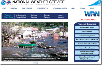
As far as what to do before a tsunami threatens, READY.GOV has a Tsunami Awareness Page with helpful hints, as does the National Weather Service
 

image


While it may seem unlikely that a tsunami will affect you or your region - this is just one of many potential hazards that may threaten you and your community - and they all require similar preparedness steps.

Knowing your local threats, whether they be tsunamis, forest fires, floods, earthquakes or hurricanes  . . . and then becoming prepared to deal with them, will provide you and your family the best safety insurance available.


To become better prepared, visit the Ready.gov site today.

image

Credit Ready.gov

To learn how to prepare as an individual, family, business owner, or community I would invite you to visit the following sites.


FEMA http://www.fema.gov/index.shtm

READY.GOV http://www.ready.gov/

AMERICAN RED CROSS http://www.redcross.org/


And a sampling of some of my general preparedness blogs includes:


When 72 Hours Isn’t Enough

In An Emergency, Who Has Your Back?

An Appropriate Level Of Preparedness

The Gift Of Preparedness – 2014 Edition

Thursday, March 05, 2015

The Caribbean’s Hidden Tsunami Potential (Revisited)

image


# 9784


Although little appreciated outside of the Indian and Pacific Ocean basins, tsunamis are a rare, but genuine threat to almost any coastal region of the globe.  Today we’ve word of a new study that finds evidence that a major tsunami struck the Yucatan coastline between 1500 and 1900 years ago.


A little over a year ago – in The Caribbean’s Hidden Tsunami Potential – we looked at a brief history of some of the destructive waves that have been spawned in the tropical waters to our south. 


In that blog I presented a  list of known or suspected Atlantic & Caribbean Tsunamis, starting off with the Great Lisbon Earthquake of 1755 (see A Look At Europe’s Seismic Risks), which also included:


    • November 1, 1755 - Lisbon, Portugal
    • October 11, 1918 - Puerto Rico
    • November 18, 1929 - Newfoundland
    • August 4, 1946 - Dominican Republic
    • August 18, 1946 - Dominican Republic
    • November 14, 1840 - Great Swell on the Delaware River
    • November 17, 1872 - Maine
    • January 9, 1926 - Maine
    • May 19, 1964 - Northeast USA

      POSSIBLE TSUNAMI

    • June 9, 1913 - Longport, NJ
    • August 6, 1923 - Rockaway Park, Queens, NY. An article on triplicate waves."
    • August 8, 1924 - Coney Island, NY. Contains a discussion, “An Observed Tsunami Building In Coastal Waters?"
    • August 19, 1931 - Atlantic City, NJ
    • September 21, 1938 - Hurricane, NJ coast.
    • July 3-4, 1992 - Daytona Beach, FL


The last suspected entry – the infamous Daytona Beach `rogue wave’ of 1992 - was described by witnesses as being between 10 and 18 feet tall, slammed onto a 27 mile stretch of Florida Beaches without warning and smashed hundreds of cars, causing as many as 75 (mostly minor) injuries.


In A Brief History of Tsunamis in the Caribbean Sea (2002), researchers James F. Lander, Lowell S. Whiteside, and Patricia A. Lockridge of NOAA’s National Geophysical Data Center  list descriptions of of  91 reported  waves over the past 500 years that might  have been  tsunamis  within  the Caribbean  region. 


Of  these, the authors judged 27 to be actual tsunamis, while nine more were considered `likely’ tsunamis’.

image

Credit - A Brief History of Tsunamis in the Caribbean Sea


Adding to this list, today we’ve a press release from the University of Colorado at Boulder which describes recently discovered evidence suggesting  a major tsunami struck along the eastern shore of Yucatan, Mexico within the past 2,000 years.


Public Release: 5-Mar-2015

Evidence indicates Yucatan Peninsula hit by tsunami 1,500 years ago

University of Colorado at Boulder

The eastern coastline of Mexico's Yucatan Peninsula, a mecca for tourists, may have been walloped by a tsunami between 1,500 and 900 years ago, says a new study involving Mexico's Centro Ecological Akumal (CEA) and the University of Colorado Boulder.

There are several lines of evidence for an ancient tsunami, foremost a large, wedge-shaped berm about 15 feet above sea level paved with washing machine-sized stones, said the researchers. Set back in places more than a quarter of a mile from shore, the berm stretches for at least 30 miles, alternating between rocky headlands and crescent beaches as it tracks the outline of the Caribbean coast near the plush resorts of Playa del Carmen and Cancun.

Radiocarbon dates of peat beneath the extensive berm indicate a tsunami, which may have consisted of two or even three giant waves, likely slammed the coastline sometime after A.D. 450. In addition, ruins of Post-Classic Mayan structures built between A.D. 900 and 1200 were found atop parts of the berm, indicating the tsunami occurred prior to that time.

<SNIP>

One implication of the Yucatan tsunami is the potential destruction another one could cause. While the geologic evidence indicates tsunamis in the region are rare -- only 37 recorded in the Caribbean basin since 1492 -- the Yucatan coastline, which was only lightly populated by Mayans 1,500 years ago, is now home to a number of lavish resort communities and villages inhabited by some 1.4 million people.

"If such an event occurs in the future, it would wreak havoc along the built-up coastline, probably with a great loss of life," said Benson. But it's far more likely that powerful hurricanes like the Class 5 Hurricane Gilbert that made landfall on the Yucatan Peninsula in 1988, killing 433 people in the Caribbean and the Gulf of Mexico and causing more than $7 billion in damage, will slam the coastline, said the researchers.


In 2013 the  USGS warned the Earthquake/Tsunami Hazard in Caribbean Higher Than Previously Thought, stating `Enough strain may be currently stored in an earthquake zone near the island of Guadeloupe to cause a magnitude 8 or larger earthquake and subsequent tsunami in the Caribbean’


Beyond damage to local islands, it is not inconceivable that a large Caribbean or Atlantic origin tsunami could negatively impact the coastlines of the Gulf states, the Eastern Seaboard, Mexico, Central and South America, and even parts of Africa and Europe.


You can access current Tsunami warnings and arrival times at the  Pacific Tsunami Warning Center.


As far as what to do before a tsunami threatens, READY.GOV has a Tsunami Awareness Page with helpful hints.NOAA  provides several useful documents, including a Tsunami Zone PDF (see below) and Tsunami Web page.

image

Tsunamis, while comparatively rare, are just one of scores of possible disaster scenarios that one can find themselves suddenly thrust into.


When you add in the risks from earthquakes, hurricanes, tornadoes, floods, blizzards, and other – even more common – emergencies, it makes sense to maintain a general level of preparedness against `all threats’.

Everyone needs an appropriate disaster plan, just as everyone should have a good first aid kit, a `bug-out bag’, and sufficient emergency supplies to last a bare minimum of 72 hours.


As the graphic above from NOAA advises, people should consider maintaining a 2-week supply of supplies in their home.  A topic I address in When 72 Hours Isn’t Enough.


As we move into the spring severe storm season, and ultimately back into the Atlantic Hurricane season, now is a good time to review and refresh your emergency preparedness plans.

Tuesday, March 25, 2014

Tsunami Preparedness Week: Because It Has Happened Here


image

Credit Tsunami.gov


# 8400


Thursday of this week marks the 50th anniversary of the biggest earthquake ever recorded in America’s history – the 1964 `Good Friday’ Alaskan quake, which registered a 9.2 magnitude.  The resultant tsunami not only affected the Alaskan coastline, but that of Western Canada and the West Coast of the United States.


Tsunami effects were felt as far away as Hawaii and (to a far lesser extent) Japan.  The following 4 minute video from the USGS illustrates the power and effect of this great quake.


While great quakes and Tsunamis don’t happen often, they are a very real hazard, and so each year we observe Tsunami Preparedness Week


While primarily thought of as a West Coast, or Pacific Ocean hazard, Tsunamis have also swept across the Atlantic and Caribbean basin as well, something we looked at in depth a couple of months ago in The Caribbean’s Hidden Tsunami Potential.


Last year the USGS released a report detailing the likely West Coast impact of a tsunami generated by a 9.1 Alaskan earthquake – and the numbers are sobering.  

This from the USGS news release  Experts Team Up on Tsunami Resilience in California:

In this scenario approximately 750,000 people would need to be evacuated, with 90,000 of those being tourists and visitors. Additionally, one-third of the boats in California's marinas could be damaged or completely sunk, resulting in $700 million in losses. It was concluded that neither of California's nuclear power plants would likely be damaged by this particular event.

The study (link) also estimates damage to marinas, businesses and homes range between $3.5 billion and $6 billion, and as many as 8,500 could be left homeless.


An even greater threat lurks along the Cascadia Fault line, which runs parallel to the Pacific Northwest Coastline and has a long history of a producing major earthquakes and tsunamis, the last one in the year 1700.

image

The geological record indicates massive quakes have struck the region at least 7 times over the past 3500 years. Given enough time, another is sure to strike again.  We looked at the threats posed by this particular fault line back in 2011 in Just A Matter Of Time.


You can access current Tsunami warnings and arrival times at the  Pacific Tsunami Warning Center.

image

As far as what to do before a tsunami threatens, READY.GOV has a Tsunami Awareness Page with helpful hints.


Before a Tsunami

The following are things you can do to protect yourself, your family and your property from the effects of a tsunami:

  • To begin preparing, you should build an emergency kit and make a family communications plan.
    • Talk to everyone in your household about what to do if a tsunami occurs. Create and practice an evacuation plan for your family. Familiarity may save your life. Be able to follow your escape route at night and during inclement weather. You should be able to reach your safe location on foot within 15 minutes. Practicing your plan makes the appropriate response more of a reaction, requiring less thinking during an actual emergency.
    • If the school evacuation plan requires you to pick your children up from school or from another location. Be aware telephone lines during a tsunami watch or warning may be overloaded and routes to and from schools may be jammed.
    • Knowing your community's warning systems and disaster plans, including evacuation routes.
  • Know the height of your street above sea level and the distance of your street from the coast or other high-risk waters. Evacuation orders may be based on these numbers.
  • If you are a tourist, familiarize yourself with local tsunami evacuation protocols. You may be able to safely evacuate to the third floor and higher in reinforced concrete hotel structures.
  • If an earthquake occurs and you are in a coastal area, turn on your radio to learn if there is a tsunami warning.


While it may seem unlikely that a tsunami will affect you or your region - this is just one of many potential hazards that may threaten you and your community - and they all require similar preparedness steps.

Knowing your local threats, whether they be tsunamis, forest fires, floods, earthquakes or hurricanes  . . . and then becoming prepared to deal with them, will provide you and your family the best safety insurance available.


For more information I would encourage you to visit:


FEMA http://www.fema.gov/index.shtm

READY.GOV http://www.ready.gov/

AMERICAN RED CROSS http://www.redcross.org/


A few of my (many) blogs on disaster preparedness include:

  • In An Emergency, Who Has Your Back?
  • When 72 Hours Isn’t Enough
  • When Evacuation Is The Better Part Of Valor
  • Tuesday, February 18, 2014

    Caribbean 6.5 Mag Quake – No Widespread Tsunami Threat

    image

    # 8308


    Just over a month ago, after a pair of earthquakes stuck Cuba (m 5.1) and just north of Puerto Rico (m 6.4), we talked about The Caribbean’s Hidden Tsunami Potential, and its not inconsequential history of seismic events. Earthquakes, major volcanic eruptions, and deadly tsunamis – while rare – are not unheard of across the Caribbean basin.


    Earlier this morning another earthquake – this time pegged by the USGS as a 6.5 magnitude – struck west of Barbados, and while it doesn’t appear to have generated a tsunami or produced any serious damage in the region, reminds us of the destructive potential of such quakes in the region.

    image


    The NWS Pacific Tsunami Warning Center issued the following statement regarding this quake:

    EVALUATION

    A DESTRUCTIVE WIDESPREAD TSUNAMI THREAT DOES NOT EXIST BASED ON HISTORICAL EARTHQUAKE AND TSUNAMI DATA. HOWEVER - THERE IS THE SMALL POSSIBILITY OF A LOCAL OR REGIONAL TSUNAMI THAT COULD AFFECT COASTS LOCATED USUALLY NO MORE THAN A FEW HUNDRED KILOMETERS FROM THE EARTHQUAKE EPICENTER. AUTHORITIES IN THE REGION NEAR THE EPICENTER SHOULD BE MADE AWARE OF THIS POSSIBILITY.


    Early reports from Sky News indicated no damage at the Island’s capital city Bridgetown.


    While rare, READY.GOV has a Tsunami Awareness Page with helpful hints. NOAA  provides several useful documents, including a Tsunami Zone PDF (see below) and Tsunami Web page.

    image


    Tsunami awareness and preparedness for those in living or working in coastal regions is just one facet of what should be an all-threats preparedness plan, designed to handle a wide range of scenarios including tornadoes, hurricanes, floods, earthquakes, and even a pandemic.


    As we move towards the spring severe storm season, and ultimately back into the Atlantic Hurricane season, now is a good time to review and refresh your emergency preparedness plans.


    For more on  disaster preparedness, I would invite you to visit Ready.gov, FEMA,  or revisit these blogs:

    In An Emergency, Who Has Your Back?
    An Appropriate Level Of Preparedness

    The Gift Of Preparedness: 2013

    Monday, January 13, 2014

    The Caribbean’s Hidden Tsunami Potential

    image

    Credit http://oceantoday.noaa.gov/tsunamiawareness/


    # 8167


    With two moderately strong earthquakes rocking the Caribbean in the past week, and dozens of smaller temblors, it’s probably a good time to talk about the small – but still very real– potential of seeing a destructive tsunami generated from a Caribbean earthquake. 

    image

    Caribbean Quakes last 7 day – USGS


    Last week’s 5.1 quake in Cuba was felt in Miami and Key West, and even as far north as Tampa, Florida (see Tampa Bay Times article Effects of moderate earthquake near Cuba felt in Tampa Bay area).


    Admittedly, the Pacific and Indian Oceans are best known for these destructive tidal waves, with 2004’s Sumatran Earthquake / Tsunami and 2011’s Great Japan Earthquake / Tsunami together claiming more than 200,000 lives.  But  these are not the only oceans capable of generating destructive waves.


    Last March, in Tsunami Preparedness Week, I presented a a  list of known or suspected Atlantic & Caribbean Tsunamis, starting off with the Great Lisbon Earthquake of 1755 (see A Look At Europe’s Seismic Risks), which included:

      • November 1, 1755 - Lisbon, Portugal
      • October 11, 1918 - Puerto Rico
      • November 18, 1929 - Newfoundland
      • August 4, 1946 - Dominican Republic
      • August 18, 1946 - Dominican Republic
      • November 14, 1840 - Great Swell on the Delaware River
      • November 17, 1872 - Maine
      • January 9, 1926 - Maine
      • May 19, 1964 - Northeast USA

        POSSIBLE TSUNAMI

      • June 9, 1913 - Longport, NJ
      • August 6, 1923 - Rockaway Park, Queens, NY. An article on triplicate waves."
      • August 8, 1924 - Coney Island, NY. Contains a discussion, “An Observed Tsunami Building In Coastal Waters?"
      • August 19, 1931 - Atlantic City, NJ
      • September 21, 1938 - Hurricane, NJ coast.
      • July 3-4, 1992 - Daytona Beach, FL

    The last suspected entry – the infamous Daytona Beach `rogue wave’ of 1992 - was described by witnesses as being between 10 and 18 feet tall, slammed onto a 27 mile stretch of Florida Beaches without warning and smashed hundreds of cars, causing as many as 75 (mostly minor) injuries.


    Twice in 1946, Caribbean earthquakes generated (minimal) tsunamis recorded along the Eastern Seaboard as far north as Atlantic City, NJ although they did considerable damage, and claimed lives, closer to the epicenter. 


    In A Brief History of Tsunamis in the Caribbean Sea (2002), researchers James F. Lander, Lowell S. Whiteside, and Patricia A. Lockridge of NOAA’s National Geophysical Data Center  list descriptions of of  91 reported  waves over the past 500 years that might  have been  tsunamis  within  the Caribbean  region. 


    Of  these, the authors judged 27 to be actual tsunamis, while nine more were considered `likely’ tsunamis’.image

    Credit - A Brief History of Tsunamis in the Caribbean Sea


    In 2005, The Woods Hole Oceanographic Institution warned:


    Major Caribbean Earthquakes and Tsunamis a Real Risk

    Events rare, but scientists call for public awareness, warning system

    January 13, 2005

    Shelley Dawicki

    A dozen major earthquakes of magnitude 7.0 or greater have occurred in the Caribbean near Puerto Rico, the U.S. Virgin Islands and the island of Hispaniola, shared by Haiti and the Dominican Republic, in the past 500 years, and several have generated tsunamis. The most recent major earthquake, a magnitude 8.1 in 1946, resulted in a tsunami that killed a reported 1,600 people.


    With nearly twenty million people now living in this tourist region and a major earthquake occurring on average every 50 years, scientists say it is not a question of if it will happen but when. They are calling for the establishment of tsunami early warning systems in the Caribbean Sea, Gulf of Mexico and Atlantic Ocean, and better public education about the real tsunami threats in these regions.

    (Continue . . . )


    And just last month the USGS warned of the threat in the following press release:


    Earthquake/Tsunami Hazard in Caribbean Higher Than Previously Thought


    Released: 12/20/2013 6:18:08 PM

    Contact Information:
    U.S. Department of the Interior, U.S. Geological Survey
    Office of Communications and Publishing
     

    Enough strain may be currently stored in an earthquake zone near the island of Guadeloupe to cause a magnitude 8 or larger earthquake and subsequent tsunami in the Caribbean, according to a new U.S. Geological Survey study.

    USGS and French researchers studying the plate boundary in the Lesser Antilles region—the area where 20 of the 26 Caribbean islands are located—estimate that enough unreleased strain may have accumulated offshore of Guadeloupe to potentially create a magnitude 8.0-8.4 earthquake. A magnitude 7.5-8.5 quake in 1843 killed several thousand people in Guadeloupe, and a similar quake in the future could cause several tens to several hundreds of fatalities, and hundreds of millions to billions of U.S. dollars in damages. The paper was recently published in the Geophysical Journal International.

    "Perception that a mega quake can occur in the Caribbean is low because none have been observed over the past century, and the rate at which the tectonic plates converge is fairly slow," said USGS scientist Gavin Hayes, lead author of the paper. "Nevertheless, we show that enough unreleased strain may have accumulated on the subduction zone since the 19th century to generate a mega quake in the future."

    (Continue . . . )


    From NOAA, we’ve a short (3 minute) video on Tsunamis that helps explain the threat.  Click through to watch on their website:

    image


    You can access current Tsunami warnings and arrival times at the  Pacific Tsunami Warning Center.

    image


    As far as what to do before a tsunami threatens, READY.GOV has a Tsunami Awareness Page with helpful hints.NOAA  provides several useful documents, including a Tsunami Zone PDF (see below) and Tsunami Web page.

    image

    Tsunamis, while comparatively rare, are just one of scores of possible disaster scenarios that one can find themselves suddenly thrust into.


    When you add in the risks from earthquakes, hurricanes, tornadoes, floods, blizzards, and other – even more common – emergencies, it makes sense to maintain a general level of preparedness against `all threats’.

    Everyone needs an appropriate disaster plan, just as everyone should have a good first aid kit, a `bug-out bag’, and sufficient emergency supplies to last a bare minimum of 72 hours.


    As the graphic above from NOAA advises, people should consider maintaining a 2-week supply of supplies in their home.  A topic I address in When 72 Hours Isn’t Enough.


    As we move into the spring severe storm season, and ultimately back into the Atlantic Hurricane season, now is a good time to review and refresh your emergency preparedness plans.


    For more on  disaster preparedness, I would invite you to visit Ready.gov, FEMA,  or revisit these blogs:


    In An Emergency, Who Has Your Back?

    An Appropriate Level Of Preparedness

    The Gift of Preparedness 2012


    Saturday, September 07, 2013

    NPM13: The USGS West Coast Tsunami Scenario Report


    image

    USGS Tsunami Report


    # 7637


    Large tsunamis are rare enough in the United States that most Americans give them little thought – they consider them to be disasters that only threaten the Far East or islands of the Western Pacific.


    But as we’ve discussed before (see East Coast Tsunami Threats & Just A Matter Of Time), the coastal regions of the United States are not immune to these destructive tidal waves.


    Earlier this week the USGS released a report detailing the likely West Coast impact of a tsunami generated by a 9.1 Alaskan earthquake – and the numbers are sobering.  


    This from the USGS news release  Experts Team Up on Tsunami Resilience in California:


    In this scenario approximately 750,000 people would need to be evacuated, with 90,000 of those being tourists and visitors. Additionally, one-third of the boats in California's marinas could be damaged or completely sunk, resulting in $700 million in losses. It was concluded that neither of California's nuclear power plants would likely be damaged by this particular event.


    The study (below) also estimates damage to marinas, businesses and homes range between $3.5 billion and $6 billion, and as many as 8,500 could be left homeless.


    The SAFRR (Science Application for Risk Reduction) Tsunami Scenario—Executive Summary and Introduction

    By Stephanie L. Ross, Lucile M. Jones, Kevin Miller, Keith A. Porter, Anne Wein, Rick I. Wilson, Bohyun Bahng, Aggeliki Barberopoulou, Jose C. Borrero, Deborah M. Brosnan, John T. Bwarie, Eric L. Geist, Laurie A. Johnson, Stephen H. Kirby, William R. Knight, Kate Long, Patrick Lynett, Carl E. Mortensen, Dmitry J. Nicolsky, Suzanne C. Perry, Geoffrey S. Plumlee, Charles R. Real, Kenneth Ryan, Elena Suleimani, Hong Kie Thio, Vasily V. Titov, Paul M. Whitmore, and Nathan J. Wood
    Summary

    The Science Application for Risk Reduction (SAFRR) tsunami scenario depicts a hypothetical but plausible tsunami created by an earthquake offshore from the Alaska Peninsula and its impacts on the California coast. The tsunami scenario is a collaboration between the U.S. Geological Survey (USGS), the California Geological Survey, the California Governor’s Office of Emergency Services (Cal OES), the National Oceanic and Atmospheric Administration (NOAA), other Federal, State, County, and local agencies, private companies, and academic and other institutions.


    This document presents evidence for past tsunamis, the scientific basis for the source, likely inundation areas, current velocities in key ports and harbors, physical damage and repair costs, economic consequences, environmental and ecological impacts, social vulnerability, emergency management and evacuation challenges, and policy implications for California associated with this hypothetical tsunami.


    We also discuss ongoing mitigation efforts by the State of California and new communication products. The intended users are those who need to make mitigation decisions before future tsunamis, and those who will need to make rapid decisions during tsunami events. The results of the tsunami scenario will help managers understand the context and consequences of their decisions and how they may improve preparedness and response. An evaluation component will assess the effectiveness of the scenario process for target stakeholders in a separate report to improve similar efforts in the future.

    Report PDF (2.6 MB)


    An Alaskan quake isn’t the only seismic scenario that could bring a destructive tsunami to our shores.  The Cascadian fault off the Pacific Northwest has a long history of a producing major earthquakes, the last one in the year 1700.


    image


    The geological record indicates massive quakes have struck the region at least 7 times over the past 3500 years. Given enough time, another is sure to strike again.


    While far less common that their Pacific counterparts, east coast tsunamis - by reason of geography, population density, and a general lack of public awareness - have the potential to be extremely dangerous as well.


    Courtesy of a tweet from FEMA Director Craig Fugate last year I found this fascinating slideshow training presentation on the East Coast Tsunami Threat.


    One of the slides in this 29 minute presentation shows that while they happen less often than Pacific tsunamis, historically the east coast death toll is almost as great as those from the west coast.


    image


    Depending upon the type of precipitating event (seismic activty, landslide, asteroid/meteor impact, etc) and the location, tsunami travel and warning times around the Atlantic will vary from minutes to many hours.

    image

    image

    You can access current Tsunami warnings and arrival times at the  Pacific Tsunami Warning Center.

    image


    As far as what to do before a tsunami threatens, READY.GOV has a Tsunami Awareness Page with helpful hints.


    With September being National Preparedness Month this is a good time to consider what disaster threats are likely, or at least possible, where you live and work and to make plans on how you would deal with them.


    While it may seem unlikely that a tsunami will affect you or your region - this is just one of many potential hazards that may threaten you and your community - and they all require similar preparedness steps.


    Knowing your local threats, whether they be tsunamis, forest fires, floods, earthquakes or hurricanes  . . . and then becoming prepared to deal with them, will provide you and your family the best safety insurance available.


    For more information I would invite you to visit:


    FEMA http://www.fema.gov/index.shtm

    READY.GOV http://www.ready.gov/

    AMERICAN RED CROSS http://www.redcross.org/


    Note: I’m still away from my desk, and so my blogging schedule will be light until I return on Sunday.  I would invite you to visit Crofsblog, Virology Down Under, and FluTrackers for the latest infection disease news.

    Wednesday, March 27, 2013

    Update On Mt. Hekla


    image

    Mt. Hekla Webcam


    # 7034


    Over the past 24 hours a blog that I wrote back in 2011 (Watching Mt. Hekla) has received a number of fresh hits, primarily because Iceland’s massive volcano has shown signs of stirring over the past couple of days.


    This 1,491 meter (4,892 ft) stratovolcano is located in the south of Iceland, and has seen at least 20 eruptions since the year 874, some of them massive and going on for months. 


    Mt. Hekla is located not far from the far-more-difficult-to-pronounce – Eyjafjallajökull - whose eruptions in April and May of 2010 closed down air traffic over parts of Europe and caused considerable economic impact.


    Mt. Hekla last erupted in the year 2000. 


    According to a pair of reports appearing in Iceland Review Online  since yesterday, seismic activity has forced local officials to declare a `level of uncertainty’ regarding this volcano.


    First, yesterday morning:


    March 26 | Possible Eruption in South Iceland’s Hekla Volcano

    hekla_psThe civil protection department has declared a level of uncertainty because of seismic activity in the volcano Hekla in South Iceland as announced by the National Commissioner of the Icelandic Police and chief of police in Hvolsvöllur shortly after 11 am this morning. more

    And then later in the day:

    Daily News

    March 26 | No Update on Hekla, Situation to be Reevaluated Tomorrow

    hekla_march_2013_psThere are no observable signs that an eruption of Hekla volcano is imminent and no updates have been issued. The civil protection department will tomorrow reevaluate the level of uncertainty declared today.  more


    For a far more expert assessment on the threat posed by Mt. Hekla, I would refer you to Erik Klemetti’s excellent Wired Science Eruptions blog.


    Alert Status Raised at Iceland’s Hekla


    Erik also blogged on the renewed activity in the Canary Islands yesterday as well:


    Earthquakes, Inflation Suggest New Magma Intruding Under El Hierro


    As of this writing, there are no clear indications that either of these volcanoes are on the verge of producing a major eruption.


    Their seismic activity bears watching, however.


    While volcanic eruptions are normally a localized (albeit often destructive and traumatic) event, sometimes they can have global impact. 


    When Mount Pinatubo erupted in the Philippines in 1991, within a year its aerosol cloud had dispersed around the globe, resulting in `an overall cooling of perhaps as large as -0.4°C over large parts of the Earth in 1992-93’ (see USGS The Atmospheric Impact of the 1991 Mount Pinatubo Eruption).


    Just over a year ago, in UK: Civil Threat Risk Assessment, we looked at a short list of disaster scenarios (man-made & natural) that the Cabinet Office believe to be genuine threats to the United Kingdom.


    image


    Among these is the impact from a major volcanic eruption.


    You may be wondering about the inclusion of a Volcanic threat to a country that isn’t exactly known for its volcanoes. Their concern stems from the impact of volcanic eruptions outside of their country – notably, in Iceland. Specifically they cite:


    Severe effusive (gas-rich) volcanic eruptions abroad – The 2010 eruption of the Eyjafjallajökull volcano in Iceland showed some of the consequences that a volcanic eruption abroad can have on the UK and its citizens. Following consultation with geological and meteorological experts about the potential risks the UK faces from volcanic eruptions in Iceland or elsewhere, the assessment is that there are two main kinds of risk from volcanic eruptions. The irst is an ash-emitting eruption, similar to that in 2010. The second, which is slightly less likely than an ash-emitting eruption, but which could have widespread impacts on health, agriculture and transport, is an effusive-style eruption on the scale of the 1783–84 Laki eruption in Iceland. This second type of eruption is now one of the highest priority risks in the NRA and the NRR.

    In 1783 the Craters of Laki in Iceland erupted and over the next 8 months spewed clouds of clouds of deadly hydrofluoric acid & Sulphur Dioxide, killing over half of Iceland’s livestock and roughly 25% of their human population.


    These noxious clouds drifted over Europe, and resulted in widespread crop failures and thousands of deaths from direct exposure to these fumes. There are also anecdotal reports that suggest this eruption had short-term global climate impacts as well.


    Another eruption of the type and scale seen in 1783 – while unlikely - could present an enormous disaster scenario not only to the UK, but to all of Europe.


    Natural disasters, like disease epidemics, can have regional and even global impacts.


    Reason enough to monitor these types of threats, no matter where in the world they may be, and to be prepared to deal with whatever might come your way.


    In the United States, while Alaska and Hawaii are well known for their volcanic activity, it may surprise many Americans to learn that the United States has 169 `active’ volcanoes within its borders, with about 40 of those in the `lower 48’ states.


    Washington is one of those states with a large number of volcanoes, and so May has been proclaimed Volcano Awareness Month.


    image


    This week happens to be Tsunami Preparedness Week in the United States - and while truly destructive tsunamis are rare - FEMA and NOAA take these threats seriously.


    image


    For more on  disaster preparedness, I would invite you to visit Ready.gov, FEMA,  or revisit these blogs:


    In An Emergency, Who Has Your Back?

    An Appropriate Level Of Preparedness

    The Gift of Preparedness 2012

    Monday, March 25, 2013

    Tsunami Preparedness Week


    image


    # 7027


    Among the millions of United States coastal residents who don’t live in Hawaii or along a Pacific coastline, the threat posed by tsunamis is rarely given much thought.


    Yet the Atlantic and Caribbean are hardly immune to large earthquakes, making our Eastern seaboard and the Gulf Coastal regions vulnerable as well.


    list of known or suspected Atlantic Tsunamis, starting off with the Great Lisbon Earthquake of 1755 (see A Look At Europe’s Seismic Risks), includes:


    • November 1, 1755 - Lisbon, Portugal
    • October 11, 1918 - Puerto Rico
    • November 18, 1929 - Newfoundland
    • August 4, 1946 - Dominican Republic
    • August 18, 1946 - Dominican Republic
    • November 14, 1840 - Great Swell on the Delaware River
    • November 17, 1872 - Maine
    • January 9, 1926 - Maine
    • May 19, 1964 - Northeast USA

      POSSIBLE TSUNAMI

    • June 9, 1913 - Longport, NJ
    • August 6, 1923 - Rockaway Park, Queens, NY. An article on triplicate waves."
    • August 8, 1924 - Coney Island, NY. Contains a discussion, “An Observed Tsunami Building In Coastal Waters?"
    • August 19, 1931 - Atlantic City, NJ
    • September 21, 1938 - Hurricane, NJ coast.
    • July 3-4, 1992 - Daytona Beach, FL


    The last suspected entry – the infamous Daytona Beach `rogue wave’ of 1992 - was described by witnesses as being between 10 and 18 feet tall, slammed onto a 27 mile stretch of Florida Beaches without warning and smashed hundreds of cars, causing as many as 75 (mostly minor) injuries.


    Hawaii and the west coast are, of course, at considerably greater risk due to the seismically active `ring of fire’.  


    Perhaps most vulnerable is the Pacific Northwest, where the Cascadia fault line (see Just A Matter Of Time) is believed to have produced tsunamis in the past that rival the tidal waves that struck Japan two years ago.


    image


    All of which helps to explain why the United States government takes the tsunami threat seriously. Tsunamis may not strike often, but when they do, they can be extremely destructive.


    From NOAA, we’ve a short (3 minute) video on Tsunamis that explains the threat.  Click through to watch on their website:


    image


    Courtesy of a tweet from FEMA Director Craig Fugate last summer, I found this fascinating slideshow training presentation on the East Coast Tsunami Threat.


    One of the most remarkable slides in this 29 minute presentation shows that while they happen less often than Pacific tsunamis, historically the east coast death toll is almost as great as those from the west coast.


    image

    Depending upon the type of precipitating event (seismic activty, landslide, asteroid/meteor impact, etc) and the location, tsunami travel and warning times around the Atlantic will vary from minutes to many hours.


    image

    image

    You can access current Tsunami warnings and arrival times at the  Pacific Tsunami Warning Center.

    image

    As far as what to do before a tsunami threatens, READY.GOV has a Tsunami Awareness Page with helpful hints.NOAA  provides several useful documents, including a Tsunami Zone PDF (see below) and Tsunami Fact Sheet.


    image


    Tsunamis, while comparatively rare, are just one of scores of possible disaster scenarios that one can find themselves suddenly thrust into.


    When you add in the risks from earthquakes, hurricanes, tornadoes, floods, blizzards, and other – even more common – emergencies, it makes sense to maintain a general level of preparedness against `all threats’.


    Everyone needs an appropriate disaster plan, just as everyone should have a good first aid kit, a `bug-out bag’, and sufficient emergency supplies to last a bare minimum of 72 hours.


    As the graphic above from NOAA advises, people should consider maintaining a 2-week supply of supplies in their home.  A topic I address in When 72 Hours Isn’t Enough.


    As we move into the spring severe storm season, and ultimately back into the Atlantic Hurricane season, now is a good time to review and refresh your emergency preparedness plans.


    For more on  disaster preparedness, I would invite you to visit Ready.gov, FEMA,  or revisit these blogs:


    In An Emergency, Who Has Your Back?

    An Appropriate Level Of Preparedness

    The Gift of Preparedness 2012

    Sunday, October 28, 2012

    Haida Gwaii Quake & Tsunami Advisories

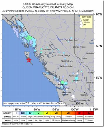
    image

    Credit USGS


    # 6672


    Overnight, while I was offline, a 7.7 quake struck the sparsely populated Haida Gwaii region, or Queen Charlotte Islands, on the northern coast of British Columbia. 


    There are no reports, as yet, on injuries or damages.  Since the initial quake, there have been dozens of aftershocks, some as strong as 5.1.


    Crawford Kilian, over at Crofsblog, lives south of there on Vancouver Island, and has blogged a number of times on the quake including here, here, and here.


    Although a minor tsunami was apparently generated, the Pacific Tsunami Warning Center has recently downgraded the earlier alerts for Hawaii with the following advisory.


    TSUNAMI MESSAGE NUMBER  10


    NWS PACIFIC TSUNAMI WARNING CENTER EWA BEACH HI
    101 AM HST SUN OCT 28 2012

    TO - CIVIL DEFENSE IN THE STATE OF HAWAII

    SUBJECT - TSUNAMI ADVISORY

    THE TSUNAMI WARNING IS NOW CANCELLED FOR THE STATE OF HAWAII.

    A TSUNAMI ADVISORY IS ISSUED FOR THE STATE OF HAWAII EFFECTIVE


    AT 1254 AM HST.

    AN EARTHQUAKE HAS OCCURRED WITH THESE PRELIMINARY PARAMETERS

       ORIGIN TIME - 0504 PM HST 27 OCT 2012
       COORDINATES - 52.8 NORTH  131.8 WEST
       LOCATION    - QUEEN CHARLOTTE ISLANDS REGION

       MAGNITUDE   - 7.7  MOMENT

    EVALUATION

    BASED ON ALL AVAILABLE DATA THE TSUNAMI THREAT HAS DECREASED AND IS NOW AT THE ADVISORY LEVEL AND NOT EXPECTED TO INCREASE. SEA  LEVEL CHANGES AND STRONG CURRENTS MAY STILL OCCUR ALONG ALL COASTS  THAT COULD BE A HAZARD TO SWIMMERS AND BOATERS AS WELL AS TO PERSONS  NEAR THE SHORE AT BEACHES AND IN HARBORS AND MARINAS. THE THREAT  MAY CONTINUE FOR SEVERAL HOURS. MESSAGES WILL BE ISSUED HOURLY OR SOONER AS CONDITIONS WARRANT.


    During the summer of 2011 I wrote extensively on Canada & the United State’s west coast earthquake and tsunami threat in a blog called Just A Matter Of Time.


    The location of this quake, well north of the populated centers of Vancouver and Washington state, greatly diminished its impact. 


    The next time, we may not be so lucky.


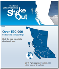
    Which is why, 10 days ago, more than a half million residents of British Columbia took part in The Great British Columbia Shakeout drill.


    image


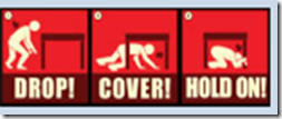
    They, along with a dozen other regions around the world, practiced Drop, Cover, and Hold On! as part of this yearly event (see NPM12: A Whole Lotta Shakeouts Going On).

    image


    A destructive quake somewhere along the Pacific Northwest coast is, as I said earlier, just a matter of time. We can’t predict when, and we certainly can’t stop it from happening.


    Leaving being ready for it as the only logical recourse.


    For a comprehensive guide on how you can prepare for `the big one’ (even if you live someplace other than Los Angeles), I would recommend you download, read, and implement the advice provided by the The L. A. County Emergency Survival Guide.

    image


    Everyone should have a disaster plan.  Everyone should have a good first aid kit, a `bug-out bag’, and sufficient emergency supplies to last a bare minimum of 72 hours.


    For more on  disaster preparedness, I would invite you to visit:


    When 72 Hours Isn’t Enough

    The L. A. County Emergency Survival Guide

    An Appropriate Level Of Preparedness